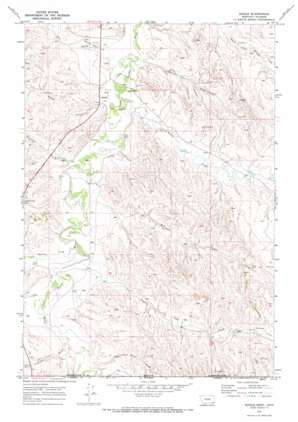
Biddle Topo Map Montana
To zoom in, hover over the map of Biddle
USGS Topo Quad 45105a3 - 1:24,000 scale
| Topo Map Name: | Biddle |
| USGS Topo Quad ID: | 45105a3 |
| Print Size: | ca. 21 1/4" wide x 27" high |
| Southeast Coordinates: | 45° N latitude / 105.25° W longitude |
| Map Center Coordinates: | 45.0625° N latitude / 105.3125° W longitude |
| U.S. States: | MT, WY |
| Filename: | o45105a3.jpg |
| Download Map JPG Image: | Biddle topo map 1:24,000 scale |
| Map Type: | Topographic |
| Topo Series: | 7.5´ |
| Map Scale: | 1:24,000 |
| Source of Map Images: | United States Geological Survey (USGS) |
| Alternate Map Versions: |
Biddle MT 1970, updated 1973 Download PDF Buy paper map Biddle MT 2011 Download PDF Buy paper map Biddle MT 2014 Download PDF Buy paper map |
1:24,000 Topo Quads surrounding Biddle
> Back to 45105a1 at 1:100,000 scale
> Back to 45104a1 at 1:250,000 scale
> Back to U.S. Topo Maps home
Biddle topo map: Gazetteer
Biddle: Dams
Kendricknumber 1 Dam elevation 1033m 3389′Biddle: Populated Places
Biddle elevation 1017m 3336′Biddle: Streams
Badger Creek elevation 1000m 3280′Blacktail Creek elevation 1005m 3297′
Bobcat Creek elevation 992m 3254′
Bowers Creek elevation 1007m 3303′
Deep Creek elevation 995m 3264′
Deer Trail Creek elevation 1020m 3346′
Deer Trail Creek elevation 1019m 3343′
Hay Creek elevation 995m 3264′
Little Hay Creek elevation 1018m 3339′
Myrtle Creek elevation 995m 3264′
Prairie Dog Creek elevation 1007m 3303′
Prairie Dog Creek elevation 1007m 3303′
Ranch Creek elevation 995m 3264′
Ranch Creek elevation 995m 3264′
Wild Bill Creek elevation 1012m 3320′
Williams Creek elevation 1001m 3284′
Biddle: Valleys
Fuller Gulch elevation 1016m 3333′Rambo Gulch elevation 1016m 3333′
Wilson Gulch elevation 1013m 3323′
Biddle: Wells
08S52E20ADA_01 Well elevation 1032m 3385′08S52E27CC__01 Well elevation 1061m 3480′
08S52E27DD__01 Well elevation 999m 3277′
08S53E29BCBB01 Well elevation 1019m 3343′
09S52E13DC__01 Well elevation 1072m 3517′
09S52E16CCCB01 Well elevation 1011m 3316′
Biddle digital topo map on disk
Buy this Biddle topo map showing relief, roads, GPS coordinates and other geographical features, as a high-resolution digital map file on DVD:
Eastern Montana & Western North Dakota
Buy digital topo maps: Eastern Montana & Western North Dakota


