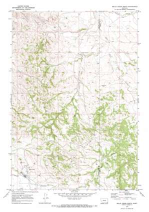
Belle Creek North Topo Map Montana
To zoom in, hover over the map of Belle Creek North
USGS Topo Quad 45105b1 - 1:24,000 scale
| Topo Map Name: | Belle Creek North |
| USGS Topo Quad ID: | 45105b1 |
| Print Size: | ca. 21 1/4" wide x 27" high |
| Southeast Coordinates: | 45.125° N latitude / 105° W longitude |
| Map Center Coordinates: | 45.1875° N latitude / 105.0625° W longitude |
| U.S. State: | MT |
| Filename: | o45105b1.jpg |
| Download Map JPG Image: | Belle Creek North topo map 1:24,000 scale |
| Map Type: | Topographic |
| Topo Series: | 7.5´ |
| Map Scale: | 1:24,000 |
| Source of Map Images: | United States Geological Survey (USGS) |
| Alternate Map Versions: |
Belle Creek North MT 1970, updated 1973 Download PDF Buy paper map Belle Creek North MT 2011 Download PDF Buy paper map Belle Creek North MT 2014 Download PDF Buy paper map |
1:24,000 Topo Quads surrounding Belle Creek North
> Back to 45105a1 at 1:100,000 scale
> Back to 45104a1 at 1:250,000 scale
> Back to U.S. Topo Maps home
Belle Creek North topo map: Gazetteer
Belle Creek North: Populated Places
Belle Creek elevation 1088m 3569′Belle Creek North: Streams
Duncan Creek elevation 1013m 3323′Belle Creek North: Valleys
Ash Draw elevation 1044m 3425′Belle Creek North: Wells
07S54E13BBCA01 Well elevation 1042m 3418′07S54E13DDDA01 Well elevation 1028m 3372′
07S54E17ADCD01 Well elevation 1083m 3553′
07S54E23DBAA01 Well elevation 1070m 3510′
07S54E24AB__01 Well elevation 1049m 3441′
07S54E25BCCB01 Well elevation 1061m 3480′
07S54E26CCCA01 Well elevation 1109m 3638′
07S55E07DDAA01 Well elevation 1031m 3382′
07S55E08AB__01 Well elevation 1037m 3402′
07S55E30ABBA01 Well elevation 1043m 3421′
07S55E32BDDD01 Well elevation 1054m 3458′
08S54E02AABD01 Well elevation 1113m 3651′
08S54E11DACC01 Well elevation 1191m 3907′
08S54E21ADA_01 Well elevation 1093m 3585′
08S54E21ADAA01 Well elevation 1097m 3599′
08S54E21ADAD01 Well elevation 1099m 3605′
08S54E21DB__01 Well elevation 1080m 3543′
Belle Creek North digital topo map on disk
Buy this Belle Creek North topo map showing relief, roads, GPS coordinates and other geographical features, as a high-resolution digital map file on DVD:
Eastern Montana & Western North Dakota
Buy digital topo maps: Eastern Montana & Western North Dakota


