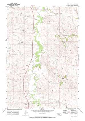
Pine Creek Topo Map Montana
To zoom in, hover over the map of Pine Creek
USGS Topo Quad 45105b3 - 1:24,000 scale
| Topo Map Name: | Pine Creek |
| USGS Topo Quad ID: | 45105b3 |
| Print Size: | ca. 21 1/4" wide x 27" high |
| Southeast Coordinates: | 45.125° N latitude / 105.25° W longitude |
| Map Center Coordinates: | 45.1875° N latitude / 105.3125° W longitude |
| U.S. State: | MT |
| Filename: | o45105b3.jpg |
| Download Map JPG Image: | Pine Creek topo map 1:24,000 scale |
| Map Type: | Topographic |
| Topo Series: | 7.5´ |
| Map Scale: | 1:24,000 |
| Source of Map Images: | United States Geological Survey (USGS) |
| Alternate Map Versions: |
Pine Creek MT 1970, updated 1973 Download PDF Buy paper map Pine Creek MT 2011 Download PDF Buy paper map Pine Creek MT 2014 Download PDF Buy paper map |
1:24,000 Topo Quads surrounding Pine Creek
> Back to 45105a1 at 1:100,000 scale
> Back to 45104a1 at 1:250,000 scale
> Back to U.S. Topo Maps home
Pine Creek topo map: Gazetteer
Pine Creek: Streams
Allison Creek elevation 964m 3162′Bear Skull Creek elevation 975m 3198′
Belle Creek elevation 974m 3195′
Bobcat Creek elevation 991m 3251′
Gumbo Creek elevation 980m 3215′
Home Creek elevation 998m 3274′
Horse Creek elevation 966m 3169′
Little Bear Skull Creek elevation 976m 3202′
North Fork Little Bear Skull Creek elevation 1007m 3303′
Pine Creek elevation 964m 3162′
Plum Creek elevation 976m 3202′
Rue Creek elevation 988m 3241′
South Fork Wright Creek elevation 1007m 3303′
Spring Creek elevation 975m 3198′
Spring Creek elevation 967m 3172′
Watt Creek elevation 981m 3218′
Wright Creek elevation 994m 3261′
Pine Creek: Summits
Bell Tower elevation 1031m 3382′Rocky Butte elevation 1002m 3287′
Pine Creek: Valleys
Big Gulch elevation 982m 3221′Pease Draw elevation 985m 3231′
Preacher Draw elevation 976m 3202′
Wolf Ravine elevation 989m 3244′
Pine Creek: Wells
07S52E02ACDC01 Well elevation 1004m 3293′07S52E10DBDC01 Well elevation 971m 3185′
07S52E11BBBB01 Well elevation 970m 3182′
07S52E21DC__01 Well elevation 1007m 3303′
07S52E26BACB01 Well elevation 975m 3198′
07S52E27ABBB01 Well elevation 987m 3238′
07S52E34BB__01 Well elevation 987m 3238′
08S52E15CCAD01 Well elevation 1005m 3297′
Pine Creek digital topo map on disk
Buy this Pine Creek topo map showing relief, roads, GPS coordinates and other geographical features, as a high-resolution digital map file on DVD:
Eastern Montana & Western North Dakota
Buy digital topo maps: Eastern Montana & Western North Dakota


