Bear Skull Mountain Topo Map Montana
To zoom in, hover over the map of Bear Skull Mountain
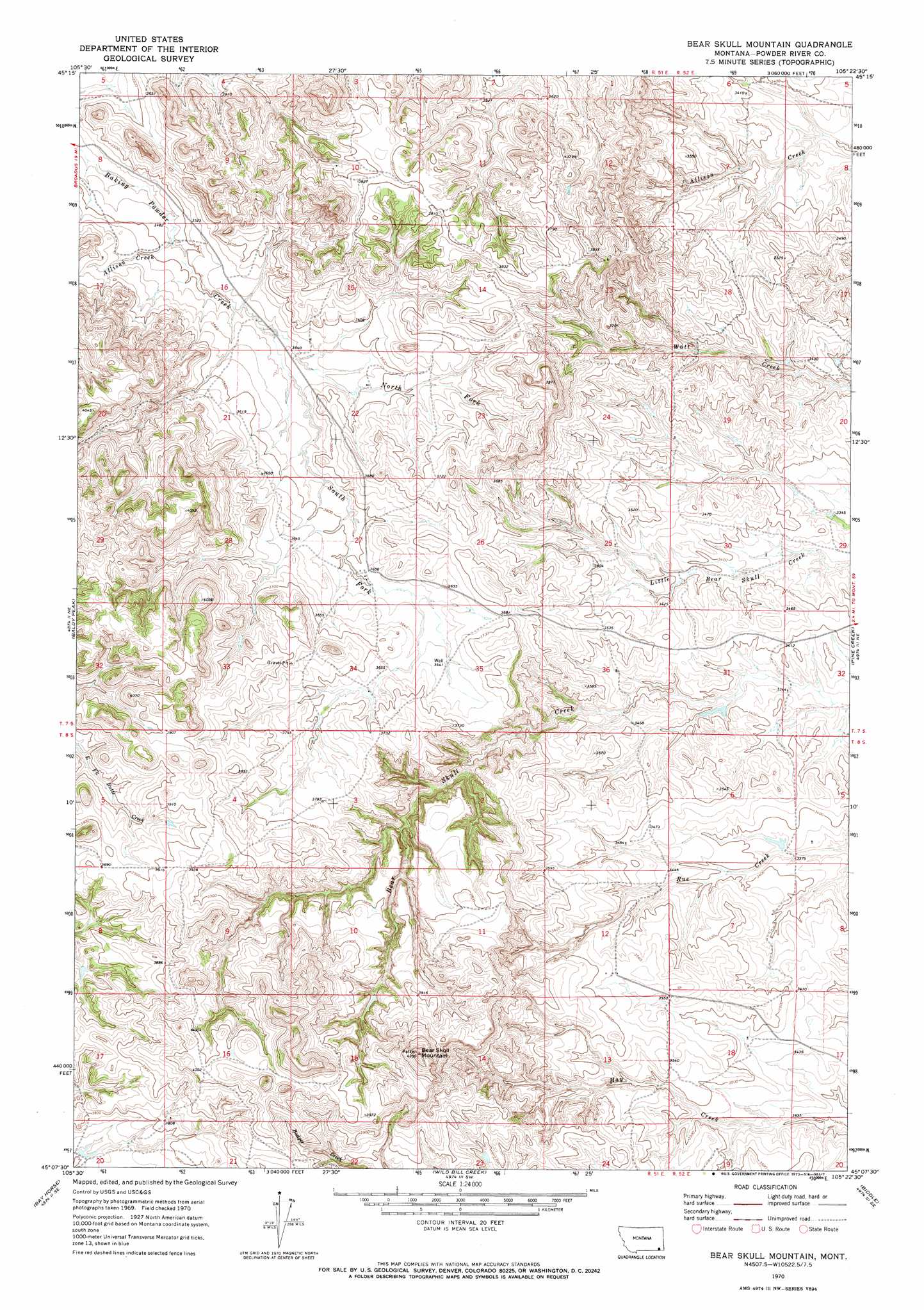
USGS Topo Quad 45105b4 - 1:24,000 scale
| Topo Map Name: | Bear Skull Mountain |
| USGS Topo Quad ID: | 45105b4 |
| Print Size: | ca. 21 1/4" wide x 27" high |
| Southeast Coordinates: | 45.125° N latitude / 105.375° W longitude |
| Map Center Coordinates: | 45.1875° N latitude / 105.4375° W longitude |
| U.S. State: | MT |
| Filename: | o45105b4.jpg |
| Download Map JPG Image: | Bear Skull Mountain topo map 1:24,000 scale |
| Map Type: | Topographic |
| Topo Series: | 7.5´ |
| Map Scale: | 1:24,000 |
| Source of Map Images: | United States Geological Survey (USGS) |
| Alternate Map Versions: |
Bear Skull Mountain MT 1970, updated 1973 Download PDF Buy paper map Bear Skull Mountain MT 2011 Download PDF Buy paper map Bear Skull Mountain MT 2014 Download PDF Buy paper map |
1:24,000 Topo Quads surrounding Bear Skull Mountain
Epsie |
Epsie Ne |
Broadus |
Monday Creek |
Little Pilgrim Butte |
Yarger Butte |
Lonesome Peak |
Eldon Mountain |
Fighting Butte |
Dry Creek Butte |
Huckins School |
Baldy Peak |
Bear Skull Mountain |
Pine Creek |
Sanburn Reservoir |
Three Bar Ranch |
Bay Horse |
Wild Bill Creek |
Biddle |
Belle Creek Sw |
Corral Creek |
Homestead Draw |
Rocky Butte |
Nipple Butte |
Mitten Butte |
> Back to 45105a1 at 1:100,000 scale
> Back to 45104a1 at 1:250,000 scale
> Back to U.S. Topo Maps home
Bear Skull Mountain topo map: Gazetteer
Bear Skull Mountain: Streams
Allison Creek elevation 1062m 3484′North Fork Baking Powder Creek elevation 1074m 3523′
South Fork Baking Powder Creek elevation 1074m 3523′
Bear Skull Mountain: Summits
Bear Skull Mountain elevation 1295m 4248′Bear Skull Mountain: Wells
07S51E27BBDA01 Well elevation 1095m 3592′07S51E34DBDB01 Well elevation 1118m 3667′
08S51E01DCDB01 Well elevation 1120m 3674′
08S51E12DCBB01 Well elevation 1091m 3579′
Bear Skull Mountain digital topo map on disk
Buy this Bear Skull Mountain topo map showing relief, roads, GPS coordinates and other geographical features, as a high-resolution digital map file on DVD:
Eastern Montana & Western North Dakota
Buy digital topo maps: Eastern Montana & Western North Dakota