Baldy Peak Topo Map Montana
To zoom in, hover over the map of Baldy Peak
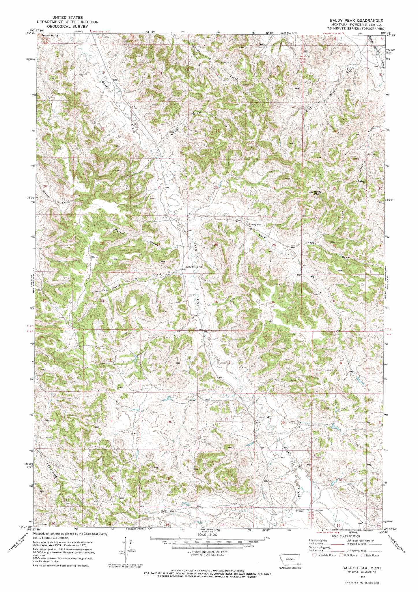
USGS Topo Quad 45105b5 - 1:24,000 scale
| Topo Map Name: | Baldy Peak |
| USGS Topo Quad ID: | 45105b5 |
| Print Size: | ca. 21 1/4" wide x 27" high |
| Southeast Coordinates: | 45.125° N latitude / 105.5° W longitude |
| Map Center Coordinates: | 45.1875° N latitude / 105.5625° W longitude |
| U.S. State: | MT |
| Filename: | o45105b5.jpg |
| Download Map JPG Image: | Baldy Peak topo map 1:24,000 scale |
| Map Type: | Topographic |
| Topo Series: | 7.5´ |
| Map Scale: | 1:24,000 |
| Source of Map Images: | United States Geological Survey (USGS) |
| Alternate Map Versions: |
Baldy Peak MT 1970, updated 1973 Download PDF Buy paper map Baldy Peak MT 2011 Download PDF Buy paper map Baldy Peak MT 2014 Download PDF Buy paper map |
1:24,000 Topo Quads surrounding Baldy Peak
Sonnette |
Epsie |
Epsie Ne |
Broadus |
Monday Creek |
Hodsdon Flats |
Yarger Butte |
Lonesome Peak |
Eldon Mountain |
Fighting Butte |
Bloom Creek |
Huckins School |
Baldy Peak |
Bear Skull Mountain |
Pine Creek |
Moorhead |
Three Bar Ranch |
Bay Horse |
Wild Bill Creek |
Biddle |
Dead Horse Lake |
Corral Creek |
Homestead Draw |
Rocky Butte |
Nipple Butte |
> Back to 45105a1 at 1:100,000 scale
> Back to 45104a1 at 1:250,000 scale
> Back to U.S. Topo Maps home
Baldy Peak topo map: Gazetteer
Baldy Peak: Streams
Cabin Creek elevation 1053m 3454′Coal Bank Creek elevation 1036m 3398′
East Fork Butte Creek elevation 1037m 3402′
Baldy Peak: Summits
Baldy Peak elevation 1293m 4242′Terrett Butte elevation 1076m 3530′
Baldy Peak: Valleys
Allison Draw elevation 1019m 3343′Marvin Draw elevation 1051m 3448′
Tracks Draw elevation 1096m 3595′
Baldy Peak: Wells
07S50E12ADBA01 Well elevation 1096m 3595′07S50E22BDAD01 Well elevation 1035m 3395′
07S50E23CCCC01 Well elevation 1045m 3428′
07S50E23CDCD01 Well elevation 1061m 3480′
07S50E26BCBC01 Well elevation 1041m 3415′
07S51E07ACDB01 Well elevation 1059m 3474′
08S50E24ABAA01 Well elevation 1105m 3625′
08S51E18CBDB01 Well elevation 1104m 3622′
Baldy Peak digital topo map on disk
Buy this Baldy Peak topo map showing relief, roads, GPS coordinates and other geographical features, as a high-resolution digital map file on DVD:
Eastern Montana & Western North Dakota
Buy digital topo maps: Eastern Montana & Western North Dakota