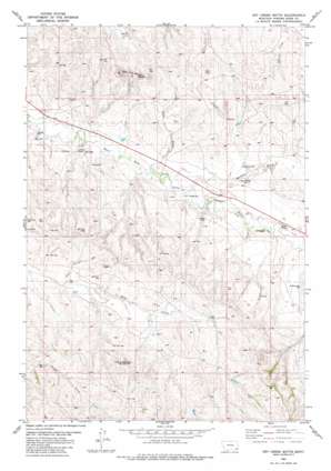
Dry Creek Butte Topo Map Montana
To zoom in, hover over the map of Dry Creek Butte
USGS Topo Quad 45105c2 - 1:24,000 scale
| Topo Map Name: | Dry Creek Butte |
| USGS Topo Quad ID: | 45105c2 |
| Print Size: | ca. 21 1/4" wide x 27" high |
| Southeast Coordinates: | 45.25° N latitude / 105.125° W longitude |
| Map Center Coordinates: | 45.3125° N latitude / 105.1875° W longitude |
| U.S. State: | MT |
| Filename: | o45105c2.jpg |
| Download Map JPG Image: | Dry Creek Butte topo map 1:24,000 scale |
| Map Type: | Topographic |
| Topo Series: | 7.5´ |
| Map Scale: | 1:24,000 |
| Source of Map Images: | United States Geological Survey (USGS) |
| Alternate Map Versions: |
Dry Creek Butte MT 1982, updated 1982 Download PDF Buy paper map Dry Creek Butte MT 2011 Download PDF Buy paper map Dry Creek Butte MT 2014 Download PDF Buy paper map |
1:24,000 Topo Quads surrounding Dry Creek Butte
> Back to 45105a1 at 1:100,000 scale
> Back to 45104a1 at 1:250,000 scale
> Back to U.S. Topo Maps home
Dry Creek Butte topo map: Gazetteer
Dry Creek Butte: Airports
Klapmeier Ranch Airport elevation 983m 3225′Dry Creek Butte: Streams
Burdette Creek elevation 961m 3152′Flat Creek elevation 994m 3261′
Dry Creek Butte: Summits
Dry Creek Butte elevation 1132m 3713′East Fork Buttes elevation 1119m 3671′
Dry Creek Butte: Valleys
Olson Gulch elevation 958m 3143′Dry Creek Butte: Wells
06S53E03DDC_01 Well elevation 966m 3169′06S53E04DDCB01 Well elevation 951m 3120′
06S53E09ADA_01 Well elevation 974m 3195′
06S53E13ACBB01 Well elevation 967m 3172′
06S53E13CD__01 Well elevation 1002m 3287′
06S53E17DC__01 Well elevation 1032m 3385′
06S53E25DCAB01 Well elevation 1032m 3385′
06S53E27DDBA01 Well elevation 1018m 3339′
06S53E28ABDC01 Well elevation 1000m 3280′
Dry Creek Butte digital topo map on disk
Buy this Dry Creek Butte topo map showing relief, roads, GPS coordinates and other geographical features, as a high-resolution digital map file on DVD:
Eastern Montana & Western North Dakota
Buy digital topo maps: Eastern Montana & Western North Dakota


