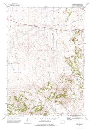
Epsie Ne Topo Map Montana
To zoom in, hover over the map of Epsie Ne
USGS Topo Quad 45105d5 - 1:24,000 scale
| Topo Map Name: | Epsie Ne |
| USGS Topo Quad ID: | 45105d5 |
| Print Size: | ca. 21 1/4" wide x 27" high |
| Southeast Coordinates: | 45.375° N latitude / 105.5° W longitude |
| Map Center Coordinates: | 45.4375° N latitude / 105.5625° W longitude |
| U.S. State: | MT |
| Filename: | o45105d5.jpg |
| Download Map JPG Image: | Epsie Ne topo map 1:24,000 scale |
| Map Type: | Topographic |
| Topo Series: | 7.5´ |
| Map Scale: | 1:24,000 |
| Source of Map Images: | United States Geological Survey (USGS) |
| Alternate Map Versions: |
Epsie NE MT 1973, updated 1977 Download PDF Buy paper map Epsie NE MT 2011 Download PDF Buy paper map Epsie NE MT 2014 Download PDF Buy paper map |
1:24,000 Topo Quads surrounding Epsie Ne
> Back to 45105a1 at 1:100,000 scale
> Back to 45104a1 at 1:250,000 scale
> Back to U.S. Topo Maps home
Epsie Ne topo map: Gazetteer
Epsie Ne: Dams
Mathew James Number 1 Dam elevation 1092m 3582′Epsie Ne: Mines
Boicourt Mine elevation 1011m 3316′Gatlin Mine elevation 1017m 3336′
Peerless Mine elevation 1052m 3451′
Epsie Ne: Streams
East Fork Wolf Creek elevation 1009m 3310′West Fork Wolf Creek elevation 1009m 3310′
Epsie Ne: Summits
Sand Creek Hill elevation 1062m 3484′Epsie Ne: Wells
04S49E13ABCC01 Well elevation 1028m 3372′04S49E13CCCD01 Well elevation 1043m 3421′
04S49E13DBCA01 Well elevation 1045m 3428′
04S49E13DBCD01 Well elevation 1050m 3444′
04S49E13DBCD02 Well elevation 1050m 3444′
04S49E25ADCC01 Well elevation 1054m 3458′
04S49E25DABB01 Well elevation 1051m 3448′
04S50E15DABB01 Well elevation 1034m 3392′
04S50E15DABC01 Well elevation 1038m 3405′
04S50E17BDAC01 Well elevation 1042m 3418′
04S50E19ACDD01 Well elevation 1050m 3444′
04S50E19CBAC01 Well elevation 1057m 3467′
04S50E20BAAA01 Well elevation 1042m 3418′
04S50E20BAAA02 Well elevation 1033m 3389′
04S50E22DBAA01 Well elevation 1087m 3566′
04S50E23DAAA01 Well elevation 1063m 3487′
04S50E31CBCC01 Well elevation 1066m 3497′
04S50E31CC__01 Well elevation 1070m 3510′
05S50E13CCCA01 Well elevation 981m 3218′
05S50E22CBA_01 Well elevation 1007m 3303′
Epsie Ne digital topo map on disk
Buy this Epsie Ne topo map showing relief, roads, GPS coordinates and other geographical features, as a high-resolution digital map file on DVD:
Eastern Montana & Western North Dakota
Buy digital topo maps: Eastern Montana & Western North Dakota


