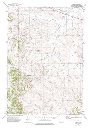
Epsie Topo Map Montana
To zoom in, hover over the map of Epsie
USGS Topo Quad 45105d6 - 1:24,000 scale
| Topo Map Name: | Epsie |
| USGS Topo Quad ID: | 45105d6 |
| Print Size: | ca. 21 1/4" wide x 27" high |
| Southeast Coordinates: | 45.375° N latitude / 105.625° W longitude |
| Map Center Coordinates: | 45.4375° N latitude / 105.6875° W longitude |
| U.S. State: | MT |
| Filename: | o45105d6.jpg |
| Download Map JPG Image: | Epsie topo map 1:24,000 scale |
| Map Type: | Topographic |
| Topo Series: | 7.5´ |
| Map Scale: | 1:24,000 |
| Source of Map Images: | United States Geological Survey (USGS) |
| Alternate Map Versions: |
Epsie MT 1973, updated 1976 Download PDF Buy paper map Epsie MT 2011 Download PDF Buy paper map Epsie MT 2014 Download PDF Buy paper map |
1:24,000 Topo Quads surrounding Epsie
> Back to 45105a1 at 1:100,000 scale
> Back to 45104a1 at 1:250,000 scale
> Back to U.S. Topo Maps home
Epsie topo map: Gazetteer
Epsie: Populated Places
Epsie elevation 1025m 3362′Epsie: Springs
04S49E31DCDA01 Spring elevation 1096m 3595′Epsie: Streams
North Fork Rock Springs Creek elevation 1025m 3362′North Fork Two Tree Creek elevation 1056m 3464′
Serviceberry Creek elevation 1043m 3421′
South Fork Rock Springs Creek elevation 1025m 3362′
Two Tree Creek elevation 1013m 3323′
Wiser Creek elevation 1017m 3336′
Epsie: Summits
Castle Rock elevation 1190m 3904′Mc Allister Butte elevation 1130m 3707′
Rattlesnake Butte elevation 1130m 3707′
Epsie: Wells
04S48E24ABDB01 Well elevation 1085m 3559′04S49E08DCBD01 Well elevation 1074m 3523′
04S49E09DDDB01 Well elevation 1045m 3428′
04S49E14BABB01 Well elevation 1020m 3346′
04S49E14BCBD01 Well elevation 1023m 3356′
04S49E14CBCD01 Well elevation 1026m 3366′
04S49E14DBBD01 Well elevation 1022m 3353′
04S49E15ADCC01 Well elevation 1024m 3359′
04S49E15BDDC01 Well elevation 1031m 3382′
04S49E15BDDD01 Well elevation 1033m 3389′
04S49E16CCBB01 Well elevation 1045m 3428′
04S49E17CDAA01 Well elevation 1053m 3454′
04S49E18DAAA01 Well elevation 1057m 3467′
04S49E22ACBA01 Well elevation 1031m 3382′
04S49E22ACBB01 Well elevation 1031m 3382′
04S49E22ACBB02 Well elevation 1032m 3385′
04S49E22BADD01 Well elevation 1031m 3382′
04S49E22DCAB01 Well elevation 1036m 3398′
04S49E23ACAC01 Well elevation 1036m 3398′
04S49E23CADD01 Well elevation 1035m 3395′
04S49E25BBDD01 Well elevation 1072m 3517′
04S49E31CCCC01 Well elevation 1128m 3700′
04S49E31DAAA01 Well elevation 1085m 3559′
04S49E33BBDA01 Well elevation 1072m 3517′
04S49E34BACA01 Well elevation 1051m 3448′
05S49E03ABDB01 Well elevation 1077m 3533′
05S49E05BABD01 Well elevation 1087m 3566′
05S49E10DAAA01 Well elevation 1109m 3638′
05S49E15ACCC01 Well elevation 1069m 3507′
05S49E19ADBA01 Well elevation 1094m 3589′
Epsie digital topo map on disk
Buy this Epsie topo map showing relief, roads, GPS coordinates and other geographical features, as a high-resolution digital map file on DVD:
Eastern Montana & Western North Dakota
Buy digital topo maps: Eastern Montana & Western North Dakota


