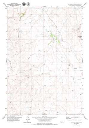
Mckenzie Creek Topo Map Montana
To zoom in, hover over the map of Mckenzie Creek
USGS Topo Quad 45105e1 - 1:24,000 scale
| Topo Map Name: | Mckenzie Creek |
| USGS Topo Quad ID: | 45105e1 |
| Print Size: | ca. 21 1/4" wide x 27" high |
| Southeast Coordinates: | 45.5° N latitude / 105° W longitude |
| Map Center Coordinates: | 45.5625° N latitude / 105.0625° W longitude |
| U.S. State: | MT |
| Filename: | o45105e1.jpg |
| Download Map JPG Image: | Mckenzie Creek topo map 1:24,000 scale |
| Map Type: | Topographic |
| Topo Series: | 7.5´ |
| Map Scale: | 1:24,000 |
| Source of Map Images: | United States Geological Survey (USGS) |
| Alternate Map Versions: |
McKenzie Creek MT 1979, updated 1979 Download PDF Buy paper map McKenzie Creek MT 2011 Download PDF Buy paper map McKenzie Creek MT 2014 Download PDF Buy paper map |
1:24,000 Topo Quads surrounding Mckenzie Creek
> Back to 45105e1 at 1:100,000 scale
> Back to 45104a1 at 1:250,000 scale
> Back to U.S. Topo Maps home
Mckenzie Creek topo map: Gazetteer
Mckenzie Creek: Ranges
Honeycomb Hills elevation 943m 3093′Mckenzie Creek: Streams
McKenzie Creek elevation 915m 3001′Pocochichee Creek elevation 915m 3001′
Mckenzie Creek: Summits
Mud Buttes elevation 1034m 3392′Pine Hill elevation 995m 3264′
Mckenzie Creek: Valleys
Garden Draw elevation 909m 2982′Rough Draw elevation 894m 2933′
Seaman Draw elevation 921m 3021′
Sheepcamp Draw elevation 940m 3083′
Mckenzie Creek: Wells
02S54E32CDB_01 Well elevation 922m 3024′02S54E35ADD_01 Well elevation 912m 2992′
03S54E04DC__01 Well elevation 902m 2959′
03S54E09DCC_02 Well elevation 914m 2998′
03S54E20BDDB01 Well elevation 937m 3074′
03S54E34BBDD01 Well elevation 933m 3061′
Mckenzie Creek digital topo map on disk
Buy this Mckenzie Creek topo map showing relief, roads, GPS coordinates and other geographical features, as a high-resolution digital map file on DVD:
Eastern Montana & Western North Dakota
Buy digital topo maps: Eastern Montana & Western North Dakota


