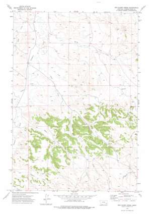
Box Elder Creek Topo Map Montana
To zoom in, hover over the map of Box Elder Creek
USGS Topo Quad 45105f6 - 1:24,000 scale
| Topo Map Name: | Box Elder Creek |
| USGS Topo Quad ID: | 45105f6 |
| Print Size: | ca. 21 1/4" wide x 27" high |
| Southeast Coordinates: | 45.625° N latitude / 105.625° W longitude |
| Map Center Coordinates: | 45.6875° N latitude / 105.6875° W longitude |
| U.S. State: | MT |
| Filename: | o45105f6.jpg |
| Download Map JPG Image: | Box Elder Creek topo map 1:24,000 scale |
| Map Type: | Topographic |
| Topo Series: | 7.5´ |
| Map Scale: | 1:24,000 |
| Source of Map Images: | United States Geological Survey (USGS) |
| Alternate Map Versions: |
Box Elder Creek MT 1973, updated 1976 Download PDF Buy paper map Box Elder Creek MT 2011 Download PDF Buy paper map Box Elder Creek MT 2014 Download PDF Buy paper map |
1:24,000 Topo Quads surrounding Box Elder Creek
> Back to 45105e1 at 1:100,000 scale
> Back to 45104a1 at 1:250,000 scale
> Back to U.S. Topo Maps home
Box Elder Creek topo map: Gazetteer
Box Elder Creek: Streams
Box Elder Creek elevation 970m 3182′Camp Creek elevation 951m 3120′
Kiwah Creek elevation 958m 3143′
Rough Creek elevation 964m 3162′
Salty Creek elevation 937m 3074′
Spring Creek elevation 940m 3083′
Squaw Creek elevation 958m 3143′
Tilton Spring Creek elevation 970m 3182′
Box Elder Creek: Wells
01S48E24CACD01 Well elevation 963m 3159′01S49E16DDBC01 Well elevation 971m 3185′
01S49E23CACD01 Well elevation 1015m 3330′
01S49E29DADA01 Well elevation 995m 3264′
01S49E30ABBA01 Well elevation 946m 3103′
01S49E31BDCC01 Well elevation 958m 3143′
02S49E18BABB01 Well elevation 982m 3221′
02S49E19CADA01 Well elevation 1049m 3441′
02S49E22CBAA01 Well elevation 1050m 3444′
02S49E22DCCA01 Well elevation 1065m 3494′
02S49E22DCCA02 Well elevation 1065m 3494′
02S49E22DCCA03 Well elevation 1065m 3494′
02S49E22DCCA04 Well elevation 1065m 3494′
02S49E22DCCA05 Well elevation 1065m 3494′
02S49E26AACA01 Well elevation 1071m 3513′
02S49E26AADA01 Well elevation 1066m 3497′
02S51E11ADBB01 Well elevation 1093m 3585′
Box Elder Creek digital topo map on disk
Buy this Box Elder Creek topo map showing relief, roads, GPS coordinates and other geographical features, as a high-resolution digital map file on DVD:
Eastern Montana & Western North Dakota
Buy digital topo maps: Eastern Montana & Western North Dakota


