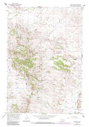
Elk Ridge Topo Map Montana
To zoom in, hover over the map of Elk Ridge
USGS Topo Quad 45105f7 - 1:24,000 scale
| Topo Map Name: | Elk Ridge |
| USGS Topo Quad ID: | 45105f7 |
| Print Size: | ca. 21 1/4" wide x 27" high |
| Southeast Coordinates: | 45.625° N latitude / 105.75° W longitude |
| Map Center Coordinates: | 45.6875° N latitude / 105.8125° W longitude |
| U.S. State: | MT |
| Filename: | o45105f7.jpg |
| Download Map JPG Image: | Elk Ridge topo map 1:24,000 scale |
| Map Type: | Topographic |
| Topo Series: | 7.5´ |
| Map Scale: | 1:24,000 |
| Source of Map Images: | United States Geological Survey (USGS) |
| Alternate Map Versions: |
Elk Ridge MT 1966, updated 1970 Download PDF Buy paper map Elk Ridge MT 1966, updated 1986 Download PDF Buy paper map Elk Ridge MT 1995, updated 1998 Download PDF Buy paper map Elk Ridge MT 2011 Download PDF Buy paper map Elk Ridge MT 2014 Download PDF Buy paper map |
| FStopo: | US Forest Service topo Elk Ridge is available: Download FStopo PDF Download FStopo TIF |
1:24,000 Topo Quads surrounding Elk Ridge
> Back to 45105e1 at 1:100,000 scale
> Back to 45104a1 at 1:250,000 scale
> Back to U.S. Topo Maps home
Elk Ridge topo map: Gazetteer
Elk Ridge: Gaps
Griffin Pass elevation 1128m 3700′Elk Ridge: Reservoirs
Buckberry Reservoir elevation 1062m 3484′Cameron Reservoir elevation 1065m 3494′
Coal Creek Reservoir elevation 1067m 3500′
Elk Ridge Reservoir elevation 1073m 3520′
Griffin Pass Reservoir elevation 1082m 3549′
John Gold Reservoir elevation 1062m 3484′
Shell Reservoir elevation 1065m 3494′
Williams Reservoir elevation 1079m 3540′
Elk Ridge: Ridges
Elk Ridge elevation 1231m 4038′Elk Ridge: Springs
Bridge Creek Spring elevation 1033m 3389′Cameron Spring elevation 1091m 3579′
Elk Ridge Spring elevation 1158m 3799′
Elk Ridge: Streams
Bridge Creek elevation 989m 3244′Corner Creek elevation 970m 3182′
Dwyer Creek elevation 985m 3231′
East Fork Little Pumpkin Creek elevation 1057m 3467′
East Prong Cottonwood Creek elevation 972m 3188′
Gould Creek elevation 994m 3261′
Marvell Creek elevation 1111m 3645′
Pass Creek elevation 993m 3257′
Rough Creek elevation 988m 3241′
Starvation Creek elevation 976m 3202′
West Fork Little Pumpkin Creek elevation 1057m 3467′
Elk Ridge: Summits
Sandefer Butte elevation 1059m 3474′Elk Ridge: Wells
01S48E17DDDD01 Well elevation 988m 3241′02S48E18BCDB01 Well elevation 1085m 3559′
02S48E19BCCA01 Well elevation 1084m 3556′
02S48E22CAAD01 Well elevation 1024m 3359′
02S48E27BDCA01 Well elevation 1019m 3343′
02S49E28CBDC01 Well elevation 1200m 3937′
Gold Well elevation 1068m 3503′
Manning Well elevation 1083m 3553′
Elk Ridge digital topo map on disk
Buy this Elk Ridge topo map showing relief, roads, GPS coordinates and other geographical features, as a high-resolution digital map file on DVD:
Eastern Montana & Western North Dakota
Buy digital topo maps: Eastern Montana & Western North Dakota


