Mills Creek West Topo Map Montana
To zoom in, hover over the map of Mills Creek West
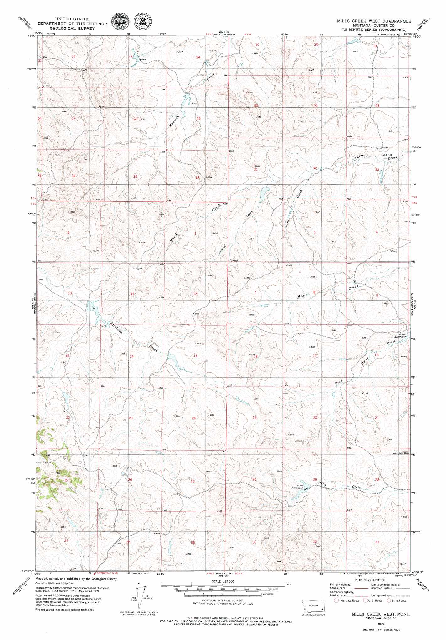
USGS Topo Quad 45105h2 - 1:24,000 scale
| Topo Map Name: | Mills Creek West |
| USGS Topo Quad ID: | 45105h2 |
| Print Size: | ca. 21 1/4" wide x 27" high |
| Southeast Coordinates: | 45.875° N latitude / 105.125° W longitude |
| Map Center Coordinates: | 45.9375° N latitude / 105.1875° W longitude |
| U.S. State: | MT |
| Filename: | o45105h2.jpg |
| Download Map JPG Image: | Mills Creek West topo map 1:24,000 scale |
| Map Type: | Topographic |
| Topo Series: | 7.5´ |
| Map Scale: | 1:24,000 |
| Source of Map Images: | United States Geological Survey (USGS) |
| Alternate Map Versions: |
Mills Creek West MT 1979, updated 1979 Download PDF Buy paper map Mills Creek West MT 2011 Download PDF Buy paper map Mills Creek West MT 2014 Download PDF Buy paper map |
1:24,000 Topo Quads surrounding Mills Creek West
Loaf Of Bread Butte |
Mizpah |
Pennock Creek |
Tepee Butte Ne |
Hooky Dam |
Miles City Creek |
Forty Creek |
Bear Jaw Creek |
Tepee Butte |
North Fork Alkali Creek |
Saddle Horse Butte |
Maxwell Butte |
Mills Creek West |
Mills Creek East |
Blacktail Creek Nw |
Witcher Reservoir |
Rattlesnake Hill |
Snake Butte |
Powderville |
Blacktail Creek Sw |
Johnnie Creek |
Cross S School |
Oliphant Butte |
Rattlesnake Ridge |
Davis Creek West |
> Back to 45105e1 at 1:100,000 scale
> Back to 45104a1 at 1:250,000 scale
> Back to U.S. Topo Maps home
Mills Creek West topo map: Gazetteer
Mills Creek West: Dams
Ash Number 1 Dam elevation 893m 2929′E Hardy Number 4 Dam elevation 955m 3133′
L Krutzfeldt Number 5 Dam elevation 985m 3231′
L Krutzfeldt Number 6 Dam elevation 996m 3267′
Love Dam elevation 962m 3156′
Mills Creek West: Reservoirs
Love Reservoir elevation 954m 3129′Mills Creek West: Streams
First Creek elevation 890m 2919′Second Creek elevation 898m 2946′
Mills Creek West: Wells
02N52E28BADC01 Well elevation 952m 3123′Mills Creek West digital topo map on disk
Buy this Mills Creek West topo map showing relief, roads, GPS coordinates and other geographical features, as a high-resolution digital map file on DVD:
Eastern Montana & Western North Dakota
Buy digital topo maps: Eastern Montana & Western North Dakota