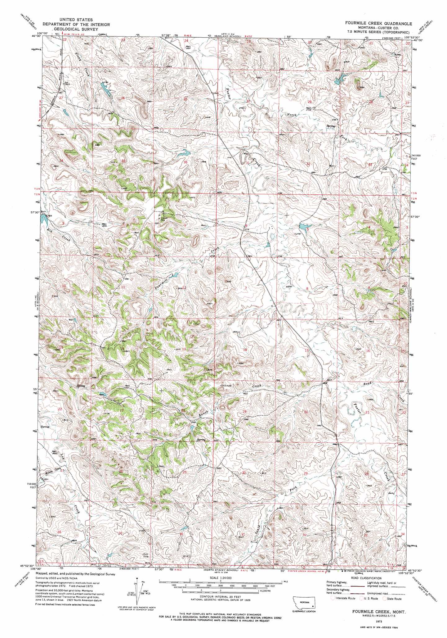
Fourmile Creek Topo Map Montana
To zoom in, hover over the map of Fourmile Creek
USGS Topo Quad 45105h8 - 1:24,000 scale
| Topo Map Name: | Fourmile Creek |
| USGS Topo Quad ID: | 45105h8 |
| Print Size: | ca. 21 1/4" wide x 27" high |
| Southeast Coordinates: | 45.875° N latitude / 105.875° W longitude |
| Map Center Coordinates: | 45.9375° N latitude / 105.9375° W longitude |
| U.S. State: | MT |
| Filename: | o45105h8.jpg |
| Download Map JPG Image: | Fourmile Creek topo map 1:24,000 scale |
| Map Type: | Topographic |
| Topo Series: | 7.5´ |
| Map Scale: | 1:24,000 |
| Source of Map Images: | United States Geological Survey (USGS) |
| Alternate Map Versions: |
Fourmile Creek MT 1973, updated 1977 Download PDF Buy paper map Fourmile Creek MT 2011 Download PDF Buy paper map Fourmile Creek MT 2014 Download PDF Buy paper map |
1:24,000 Topo Quads surrounding Fourmile Creek
Miller Creek Nw |
Moon Creek School |
Jack Creek Nw |
Circle L Creek |
Horse Creek |
Miller Creek Sw |
Miller Creek |
Garland School |
Jack Creek |
Beebe Sw |
Brandenberg Nw |
H S School |
Fourmile Creek |
Carey-Malone School |
Kirkpatrick Hill |
Brandenberg |
Hayes Point |
North Stacey School |
Foster Creek School |
Volborg |
Cook Creek Reservoir |
Beaver Creek School |
Stacey |
Elk Ridge |
Box Elder Creek |
> Back to 45105e1 at 1:100,000 scale
> Back to 45104a1 at 1:250,000 scale
> Back to U.S. Topo Maps home
Fourmile Creek topo map: Gazetteer
Fourmile Creek: Dams
Nefsy Number 1 Dam elevation 852m 2795′Nefsy Number 2 Dam elevation 841m 2759′
Nefsy Number 4 Dam elevation 855m 2805′
Fourmile Creek: Streams
Fourmile Creek elevation 835m 2739′Kelsey Creek elevation 871m 2857′
North Fork Foster Creek elevation 818m 2683′
Ranch Creek elevation 855m 2805′
Road Creek elevation 853m 2798′
South Fork Foster Creek elevation 866m 2841′
Fourmile Creek: Wells
02N46E23ABBC01 Well elevation 917m 3008′02N46E34BDAB01 Well elevation 891m 2923′
02N47E32BBBC01 Well elevation 896m 2939′
02N48E15BCBC01 Well elevation 892m 2926′
Fourmile Creek digital topo map on disk
Buy this Fourmile Creek topo map showing relief, roads, GPS coordinates and other geographical features, as a high-resolution digital map file on DVD:
Eastern Montana & Western North Dakota
Buy digital topo maps: Eastern Montana & Western North Dakota