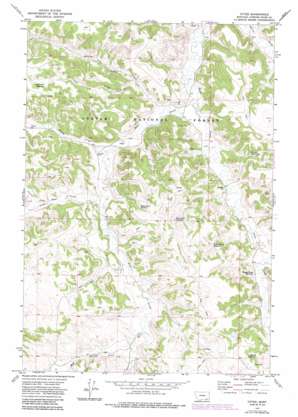
Otter Topo Map Montana
To zoom in, hover over the map of Otter
USGS Topo Quad 45106b2 - 1:24,000 scale
| Topo Map Name: | Otter |
| USGS Topo Quad ID: | 45106b2 |
| Print Size: | ca. 21 1/4" wide x 27" high |
| Southeast Coordinates: | 45.125° N latitude / 106.125° W longitude |
| Map Center Coordinates: | 45.1875° N latitude / 106.1875° W longitude |
| U.S. State: | MT |
| Filename: | o45106b2.jpg |
| Download Map JPG Image: | Otter topo map 1:24,000 scale |
| Map Type: | Topographic |
| Topo Series: | 7.5´ |
| Map Scale: | 1:24,000 |
| Source of Map Images: | United States Geological Survey (USGS) |
| Alternate Map Versions: |
Otter MT 1972, updated 1976 Download PDF Buy paper map Otter MT 1972, updated 1986 Download PDF Buy paper map Otter MT 1995, updated 1998 Download PDF Buy paper map Otter MT 2011 Download PDF Buy paper map Otter MT 2014 Download PDF Buy paper map |
| FStopo: | US Forest Service topo Otter is available: Download FStopo PDF Download FStopo TIF |
1:24,000 Topo Quads surrounding Otter
> Back to 45106a1 at 1:100,000 scale
> Back to 45106a1 at 1:250,000 scale
> Back to U.S. Topo Maps home
Otter topo map: Gazetteer
Otter: Populated Places
Otter elevation 1062m 3484′Otter: Reservoirs
Boundary Reservoir elevation 1128m 3700′Fletcher Reservoir elevation 1089m 3572′
Happy Coulee Reservoir elevation 1087m 3566′
Lost Creek Reservoir elevation 1177m 3861′
Miller Draw Reservoir elevation 1104m 3622′
Morris Reservoir elevation 1121m 3677′
Rocky Draw Reservoir elevation 1144m 3753′
Otter: Springs
07S46E31BADC01 Spring elevation 1061m 3480′08S45E03BAAB01 Spring elevation 1128m 3700′
08S45E03DAAC01 Spring elevation 1129m 3704′
08S45E04ACCD01 Spring elevation 1099m 3605′
08S45E04DCCB01 Spring elevation 1112m 3648′
08S45E08DBAA01 Spring elevation 1158m 3799′
08S45E13BCAA01 Spring elevation 1180m 3871′
08S45E14DBBA01 Spring elevation 1143m 3750′
08S45E15DBBB01 Spring elevation 1110m 3641′
08S45E16AACA01 Spring elevation 1132m 3713′
08S45E16ABAA01 Spring elevation 1131m 3710′
08S45E17AADC01 Spring elevation 1154m 3786′
08S45E21ABBC01 Spring elevation 1147m 3763′
Otter: Streams
Bear Creek elevation 1036m 3398′Bradshaw Creek elevation 1073m 3520′
Camp Creek elevation 1019m 3343′
Cub Creek elevation 1042m 3418′
Little Bear Creek elevation 1073m 3520′
Lost Creek elevation 1066m 3497′
Mud Springs Creek elevation 1116m 3661′
Tooley Creek elevation 1061m 3480′
Otter: Valleys
Colester Draw elevation 1095m 3592′Hoover Draw elevation 1094m 3589′
Miller Draw elevation 1096m 3595′
Otter: Wells
07S45E13DCCC01 Well elevation 1038m 3405′07S45E27AADA01 Well elevation 1060m 3477′
07S45E32DCBA01 Well elevation 1098m 3602′
07S45E32DCBA02 Well elevation 1098m 3602′
07S45E32DCBA03 Well elevation 1101m 3612′
07S45E34BDAB01 Well elevation 1146m 3759′
08S45E04ABAA01 Well elevation 1104m 3622′
08S45E05CBBC01 Well elevation 1150m 3772′
08S45E08DCBB01 Well elevation 1188m 3897′
08S45E10ABCB01 Well elevation 1097m 3599′
08S45E11ADDA01 Well elevation 1184m 3884′
08S45E14DDAC01 Well elevation 1167m 3828′
08S45E15CAAB01 Well elevation 1118m 3667′
08S45E16DBCB01 Well elevation 1131m 3710′
08S45E16DBCB02 Well elevation 1131m 3710′
08S45E16DDCB01 Well elevation 1122m 3681′
08S45E20AACD01 Well elevation 1138m 3733′
08S45E20BDAB01 Well elevation 1153m 3782′
08S45E22BAAA01 Well elevation 1120m 3674′
08S46E01BAAA01 Well elevation 1192m 3910′
Otter digital topo map on disk
Buy this Otter topo map showing relief, roads, GPS coordinates and other geographical features, as a high-resolution digital map file on DVD:
Eastern Montana & Western North Dakota
Buy digital topo maps: Eastern Montana & Western North Dakota


