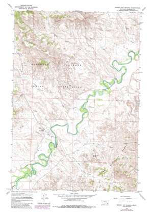
Birney Day School Topo Map Montana
To zoom in, hover over the map of Birney Day School
USGS Topo Quad 45106d4 - 1:24,000 scale
| Topo Map Name: | Birney Day School |
| USGS Topo Quad ID: | 45106d4 |
| Print Size: | ca. 21 1/4" wide x 27" high |
| Southeast Coordinates: | 45.375° N latitude / 106.375° W longitude |
| Map Center Coordinates: | 45.4375° N latitude / 106.4375° W longitude |
| U.S. State: | MT |
| Filename: | o45106d4.jpg |
| Download Map JPG Image: | Birney Day School topo map 1:24,000 scale |
| Map Type: | Topographic |
| Topo Series: | 7.5´ |
| Map Scale: | 1:24,000 |
| Source of Map Images: | United States Geological Survey (USGS) |
| Alternate Map Versions: |
Birney Day School MT 1966, updated 1969 Download PDF Buy paper map Birney Day School MT 1966, updated 1979 Download PDF Buy paper map Birney Day School MT 1966, updated 1986 Download PDF Buy paper map Birney Day School MT 1995, updated 1998 Download PDF Buy paper map Birney Day School MT 2011 Download PDF Buy paper map Birney Day School MT 2014 Download PDF Buy paper map |
| FStopo: | US Forest Service topo Birney Day School is available: Download FStopo PDF Download FStopo TIF |
1:24,000 Topo Quads surrounding Birney Day School
> Back to 45106a1 at 1:100,000 scale
> Back to 45106a1 at 1:250,000 scale
> Back to U.S. Topo Maps home
Birney Day School topo map: Gazetteer
Birney Day School: Canals
Cheyenne Ditch elevation 939m 3080′Birney Day School: Populated Places
Birney Day School elevation 941m 3087′Birney Day School: Springs
Section Line Spring elevation 976m 3202′Birney Day School: Streams
Birney Creek elevation 930m 3051′Cook Creek elevation 945m 3100′
Gate Creek elevation 928m 3044′
Longroach Creek elevation 993m 3257′
Mission Creek elevation 942m 3090′
North Fork Poker Jim Creek elevation 994m 3261′
O'Dell Creek elevation 915m 3001′
Pawnee Creek elevation 919m 3015′
Poker Jim Creek elevation 936m 3070′
Poker Teechee Creek elevation 934m 3064′
South Fork Poker Jim Creek elevation 1022m 3353′
Tie Creek elevation 925m 3034′
Birney Day School: Wells
04S43E15ABA_01 Well elevation 968m 3175′04S43E27DDD_01 Well elevation 924m 3031′
04S43E33CCD_01 Well elevation 934m 3064′
04S43E33CDD_01 Well elevation 930m 3051′
04S43E35CDCD01 Well elevation 949m 3113′
05S43E04AAAA01 Well elevation 925m 3034′
05S43E04CBC_01 Well elevation 937m 3074′
05S43E04CBDA01 Well elevation 936m 3070′
05S43E07DBDA01 Well elevation 943m 3093′
05S43E07DD__01 Well elevation 942m 3090′
05S43E08CBCC01 Well elevation 935m 3067′
05S43E08CBCC02 Well elevation 931m 3054′
05S43E16AAAD01 Well elevation 961m 3152′
05S43E17CBCB01 Well elevation 936m 3070′
05S43E18ABBD01 Well elevation 938m 3077′
05S43E18ABCA01 Well elevation 938m 3077′
05S43E18DBAA01 Well elevation 939m 3080′
Birney Day School digital topo map on disk
Buy this Birney Day School topo map showing relief, roads, GPS coordinates and other geographical features, as a high-resolution digital map file on DVD:
Eastern Montana & Western North Dakota
Buy digital topo maps: Eastern Montana & Western North Dakota


