Hollowwood Creek Topo Map Montana
To zoom in, hover over the map of Hollowwood Creek
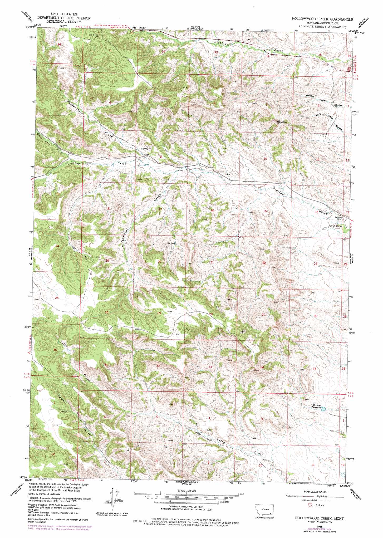
USGS Topo Quad 45106e4 - 1:24,000 scale
| Topo Map Name: | Hollowwood Creek |
| USGS Topo Quad ID: | 45106e4 |
| Print Size: | ca. 21 1/4" wide x 27" high |
| Southeast Coordinates: | 45.5° N latitude / 106.375° W longitude |
| Map Center Coordinates: | 45.5625° N latitude / 106.4375° W longitude |
| U.S. State: | MT |
| Filename: | o45106e4.jpg |
| Download Map JPG Image: | Hollowwood Creek topo map 1:24,000 scale |
| Map Type: | Topographic |
| Topo Series: | 7.5´ |
| Map Scale: | 1:24,000 |
| Source of Map Images: | United States Geological Survey (USGS) |
| Alternate Map Versions: |
Hollowwood Creek MT 1958, updated 1960 Download PDF Buy paper map Hollowwood Creek MT 1958, updated 1960 Download PDF Buy paper map Hollowwood Creek MT 1958, updated 1978 Download PDF Buy paper map Hollowwood Creek MT 2011 Download PDF Buy paper map Hollowwood Creek MT 2014 Download PDF Buy paper map |
1:24,000 Topo Quads surrounding Hollowwood Creek
Colstrip Sw |
Colstrip Se |
Hammond Draw Sw |
Hammond Draw |
Brandenberg |
Jimtown |
Badger Peak |
Garfield Peak |
Ashland Ne |
Cook Creek Reservoir |
Lame Deer |
Fisher Butte |
Hollowwood Creek |
Ashland |
Willow Crossing |
Cook Creek Butte |
Clubfoot Creek |
Birney Day School |
Green Creek |
King Mountain |
Birney Sw |
Birney |
Browns Mountain |
Poker Jim Butte |
Fort Howes |
> Back to 45106e1 at 1:100,000 scale
> Back to 45106a1 at 1:250,000 scale
> Back to U.S. Topo Maps home
Hollowwood Creek topo map: Gazetteer
Hollowwood Creek: Reservoirs
Bighead Reservoir elevation 983m 3225′Hollowwood Creek: Springs
Patrick Spring elevation 968m 3175′Hollowwood Creek: Streams
Crazy Head Fork elevation 1108m 3635′Hollowwood Creek elevation 1045m 3428′
Woodenthigh Creek elevation 1057m 3467′
Hollowwood Creek: Wells
01N42E34AABA01 Well elevation 1262m 4140′03S43E11ABAB01 Well elevation 1005m 3297′
Hollowwood Creek digital topo map on disk
Buy this Hollowwood Creek topo map showing relief, roads, GPS coordinates and other geographical features, as a high-resolution digital map file on DVD:
Eastern Montana & Western North Dakota
Buy digital topo maps: Eastern Montana & Western North Dakota