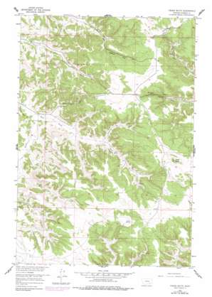
Fisher Butte Topo Map Montana
To zoom in, hover over the map of Fisher Butte
USGS Topo Quad 45106e5 - 1:24,000 scale
| Topo Map Name: | Fisher Butte |
| USGS Topo Quad ID: | 45106e5 |
| Print Size: | ca. 21 1/4" wide x 27" high |
| Southeast Coordinates: | 45.5° N latitude / 106.5° W longitude |
| Map Center Coordinates: | 45.5625° N latitude / 106.5625° W longitude |
| U.S. State: | MT |
| Filename: | o45106e5.jpg |
| Download Map JPG Image: | Fisher Butte topo map 1:24,000 scale |
| Map Type: | Topographic |
| Topo Series: | 7.5´ |
| Map Scale: | 1:24,000 |
| Source of Map Images: | United States Geological Survey (USGS) |
| Alternate Map Versions: |
Fisher Butte MT 1958, updated 1960 Download PDF Buy paper map Fisher Butte MT 2011 Download PDF Buy paper map Fisher Butte MT 2014 Download PDF Buy paper map |
1:24,000 Topo Quads surrounding Fisher Butte
> Back to 45106e1 at 1:100,000 scale
> Back to 45106a1 at 1:250,000 scale
> Back to U.S. Topo Maps home
Fisher Butte topo map: Gazetteer
Fisher Butte: Dams
Crazy Head Pond Number 3 Dam elevation 1217m 3992′Lost Leg Dam elevation 1232m 4041′
Fisher Butte: Mines
Lame Deer Strip Mine elevation 1120m 3674′Fisher Butte: Springs
Crazy Head Spring elevation 1244m 4081′Spang Spring elevation 1186m 3891′
Station Spring elevation 1233m 4045′
White Horse Spring elevation 1243m 4078′
Fisher Butte: Streams
Broken Jaw Creek elevation 1100m 3608′East Fork Lame Deer Creek elevation 1080m 3543′
South Fork Lame Deer Creek elevation 1078m 3536′
Standing Elk Creek elevation 1152m 3779′
White Buffalo Creek elevation 1123m 3684′
Fisher Butte: Summits
Fisher Butte elevation 1340m 4396′Fisher Butte: Wells
03S41E01BDAA01 Well elevation 1086m 3562′03S42E05AAA_01 Well elevation 1189m 3900′
03S42E28ACDC01 Well elevation 1200m 3937′
Fisher Butte digital topo map on disk
Buy this Fisher Butte topo map showing relief, roads, GPS coordinates and other geographical features, as a high-resolution digital map file on DVD:
Eastern Montana & Western North Dakota
Buy digital topo maps: Eastern Montana & Western North Dakota


