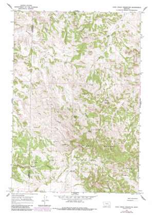
Cook Creek Reservoir Topo Map Montana
To zoom in, hover over the map of Cook Creek Reservoir
USGS Topo Quad 45106f2 - 1:24,000 scale
| Topo Map Name: | Cook Creek Reservoir |
| USGS Topo Quad ID: | 45106f2 |
| Print Size: | ca. 21 1/4" wide x 27" high |
| Southeast Coordinates: | 45.625° N latitude / 106.125° W longitude |
| Map Center Coordinates: | 45.6875° N latitude / 106.1875° W longitude |
| U.S. State: | MT |
| Filename: | o45106f2.jpg |
| Download Map JPG Image: | Cook Creek Reservoir topo map 1:24,000 scale |
| Map Type: | Topographic |
| Topo Series: | 7.5´ |
| Map Scale: | 1:24,000 |
| Source of Map Images: | United States Geological Survey (USGS) |
| Alternate Map Versions: |
Cook Creek Reservoir MT 1966, updated 1969 Download PDF Buy paper map Cook Creek Reservoir MT 1966, updated 1986 Download PDF Buy paper map Cook Creek Reservoir MT 1995, updated 1998 Download PDF Buy paper map Cook Creek Reservoir MT 2011 Download PDF Buy paper map Cook Creek Reservoir MT 2014 Download PDF Buy paper map |
| FStopo: | US Forest Service topo Cook Creek Reservoir is available: Download FStopo PDF Download FStopo TIF |
1:24,000 Topo Quads surrounding Cook Creek Reservoir
> Back to 45106e1 at 1:100,000 scale
> Back to 45106a1 at 1:250,000 scale
> Back to U.S. Topo Maps home
Cook Creek Reservoir topo map: Gazetteer
Cook Creek Reservoir: Reservoirs
Cook Creek Reservoir elevation 1043m 3421′Cottonwood Reservoir elevation 1045m 3428′
Shy Reservoir elevation 1035m 3395′
Cook Creek Reservoir: Springs
02S45E22CBBD01 Spring elevation 1110m 3641′Bringoff Spring elevation 1072m 3517′
Cliff Spring elevation 1090m 3576′
Cook Spring elevation 1096m 3595′
Cutbank Spring elevation 1114m 3654′
Daily Creek Spring elevation 1117m 3664′
Gentry Spring elevation 1107m 3631′
J O Spring elevation 1074m 3523′
Cook Creek Reservoir: Summits
Cook Mountain elevation 1282m 4206′Cook Creek Reservoir: Wells
02S45E04AAAA01 Well elevation 1018m 3339′02S45E17CBBD01 Well elevation 1016m 3333′
02S45E29BAAB01 Well elevation 1005m 3297′
04S45E08DDAD01 Well elevation 1110m 3641′
Colbert Coulee Well elevation 1016m 3333′
Cottonwood Well elevation 1011m 3316′
Cook Creek Reservoir digital topo map on disk
Buy this Cook Creek Reservoir topo map showing relief, roads, GPS coordinates and other geographical features, as a high-resolution digital map file on DVD:
Eastern Montana & Western North Dakota
Buy digital topo maps: Eastern Montana & Western North Dakota


