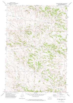
John Hen Creek Topo Map Montana
To zoom in, hover over the map of John Hen Creek
USGS Topo Quad 45106h3 - 1:24,000 scale
| Topo Map Name: | John Hen Creek |
| USGS Topo Quad ID: | 45106h3 |
| Print Size: | ca. 21 1/4" wide x 27" high |
| Southeast Coordinates: | 45.875° N latitude / 106.25° W longitude |
| Map Center Coordinates: | 45.9375° N latitude / 106.3125° W longitude |
| U.S. State: | MT |
| Filename: | o45106h3.jpg |
| Download Map JPG Image: | John Hen Creek topo map 1:24,000 scale |
| Map Type: | Topographic |
| Topo Series: | 7.5´ |
| Map Scale: | 1:24,000 |
| Source of Map Images: | United States Geological Survey (USGS) |
| Alternate Map Versions: |
John Hen Creek MT 1971, updated 1974 Download PDF Buy paper map John Hen Creek MT 2011 Download PDF Buy paper map John Hen Creek MT 2014 Download PDF Buy paper map |
1:24,000 Topo Quads surrounding John Hen Creek
> Back to 45106e1 at 1:100,000 scale
> Back to 45106a1 at 1:250,000 scale
> Back to U.S. Topo Maps home
John Hen Creek topo map: Gazetteer
John Hen Creek: Populated Places
Signal Butte (historical) elevation 937m 3074′John Hen Creek: Springs
02N43E12AC__01 Spring elevation 915m 3001′02N43E12CABB01 Spring elevation 920m 3018′
02N43E12CBAC01 Spring elevation 914m 2998′
02N44E33CACD01 Spring elevation 891m 2923′
03N43E25DDCA01 Spring elevation 887m 2910′
03N43E26ACAC01 Spring elevation 879m 2883′
03N44E28DBCC01 Spring elevation 951m 3120′
John Hen Creek: Summits
Gobblers Knob elevation 1004m 3293′John Hen Creek: Wells
02N43E02ABBD01 Well elevation 919m 3015′02N43E10DDAA01 Well elevation 895m 2936′
02N43E23CBAB01 Well elevation 880m 2887′
02N43E23CBBA01 Well elevation 878m 2880′
02N43E24CCBA01 Well elevation 892m 2926′
02N43E24CCBC01 Well elevation 892m 2926′
02N43E24CDDA01 Well elevation 898m 2946′
02N43E25BCAA01 Well elevation 903m 2962′
02N43E27AADD01 Well elevation 899m 2949′
02N43E36BAAB01 Well elevation 915m 3001′
02N43E36DBDD01 Well elevation 940m 3083′
02N44E17CABC01 Well elevation 937m 3074′
02N44E19CCCC01 Well elevation 911m 2988′
02N44E21DDDC01 Well elevation 891m 2923′
02N44E29AABA01 Well elevation 925m 3034′
02N44E29CBBB01 Well elevation 938m 3077′
02N44E32DAAC01 Well elevation 905m 2969′
02N44E33DDAC01 Well elevation 879m 2883′
02N44E34CCCD01 Well elevation 878m 2880′
03N43E26DACC01 Well elevation 872m 2860′
03N43E27ABDC01 Well elevation 874m 2867′
03N44E21CBAB01 Well elevation 994m 3261′
03N44E28DBDC01 Well elevation 966m 3169′
03N44E31BAAA01 Well elevation 897m 2942′
03N44E31CBDC01 Well elevation 915m 3001′
03N44E31CBDC02 Well elevation 919m 3015′
03N44E32BBDA01 Well elevation 910m 2985′
03N44E32BDBA01 Well elevation 917m 3008′
John Hen Creek digital topo map on disk
Buy this John Hen Creek topo map showing relief, roads, GPS coordinates and other geographical features, as a high-resolution digital map file on DVD:
Eastern Montana & Western North Dakota
Buy digital topo maps: Eastern Montana & Western North Dakota


