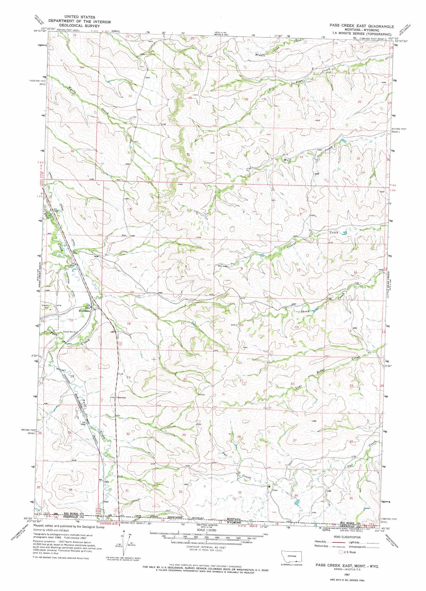
Pass Creek East Topo Map Montana
To zoom in, hover over the map of Pass Creek East
USGS Topo Quad 45107a3 - 1:24,000 scale
| Topo Map Name: | Pass Creek East |
| USGS Topo Quad ID: | 45107a3 |
| Print Size: | ca. 21 1/4" wide x 27" high |
| Southeast Coordinates: | 45° N latitude / 107.25° W longitude |
| Map Center Coordinates: | 45.0625° N latitude / 107.3125° W longitude |
| U.S. States: | MT, WY |
| Filename: | o45107a3.jpg |
| Download Map JPG Image: | Pass Creek East topo map 1:24,000 scale |
| Map Type: | Topographic |
| Topo Series: | 7.5´ |
| Map Scale: | 1:24,000 |
| Source of Map Images: | United States Geological Survey (USGS) |
| Alternate Map Versions: |
Pass Creek East MT 1967, updated 1971 Download PDF Buy paper map Pass Creek East MT 2011 Download PDF Buy paper map Pass Creek East MT 2014 Download PDF Buy paper map |
1:24,000 Topo Quads surrounding Pass Creek East
Shick Ranch |
Good Luck Creek |
Lodge Grass |
Wolf Mountain Lookout |
Spring Creek Ranch |
Willow Creek Dam |
Wyola |
Wyola Ne |
Kid Creek |
Bar V Ranch Ne |
Black Gulch |
Pass Creek West |
Pass Creek East |
Little Bear Creek |
Bar V Ranch |
West Pass |
Columbus Peak |
Dayton North |
Ranchester |
Monarch |
Burgess Junction |
Skull Ridge |
Dayton South |
Wolf |
Hultz Draw |
> Back to 45107a1 at 1:100,000 scale
> Back to 45106a1 at 1:250,000 scale
> Back to U.S. Topo Maps home
Pass Creek East topo map: Gazetteer
Pass Creek East: Canals
Thompson Ditch elevation 1197m 3927′Upper Spear Ditch elevation 1182m 3877′
Pass Creek East: Crossings
Interchange 549 elevation 1221m 4005′Pass Creek East: Populated Places
Aberdeen elevation 1196m 3923′Pass Creek East: Streams
Twin Creek elevation 1206m 3956′Twin Creek elevation 1206m 3956′
Pass Creek East: Wells
09S35E01CBAB01 Well elevation 1176m 3858′09S35E12ACAA01 Well elevation 1195m 3920′
09S35E12BABA01 Well elevation 1180m 3871′
Pass Creek East digital topo map on disk
Buy this Pass Creek East topo map showing relief, roads, GPS coordinates and other geographical features, as a high-resolution digital map file on DVD:
Eastern Montana & Western North Dakota
Buy digital topo maps: Eastern Montana & Western North Dakota