Mission Coulee Topo Map Montana
To zoom in, hover over the map of Mission Coulee
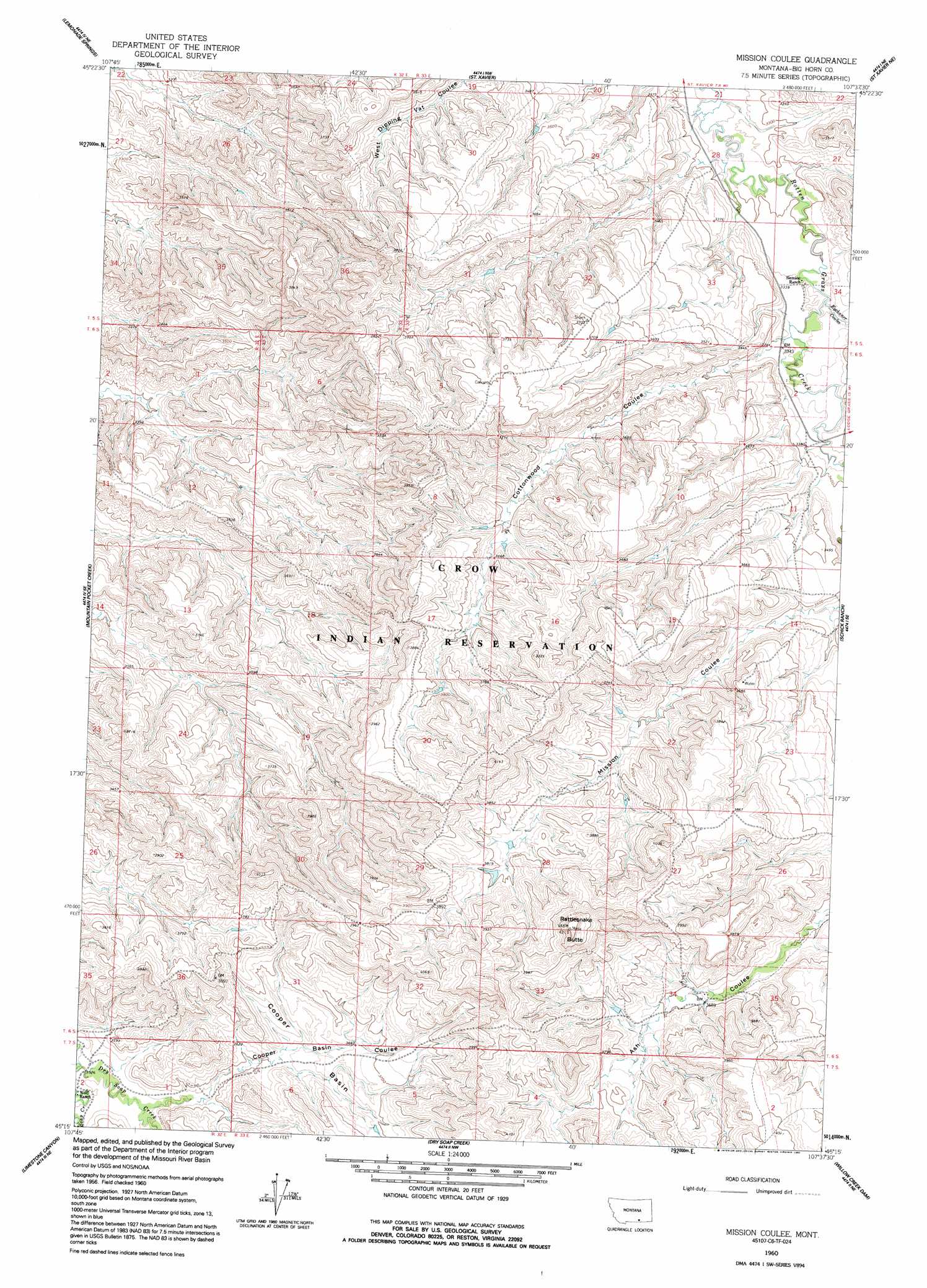
USGS Topo Quad 45107c6 - 1:24,000 scale
| Topo Map Name: | Mission Coulee |
| USGS Topo Quad ID: | 45107c6 |
| Print Size: | ca. 21 1/4" wide x 27" high |
| Southeast Coordinates: | 45.25° N latitude / 107.625° W longitude |
| Map Center Coordinates: | 45.3125° N latitude / 107.6875° W longitude |
| U.S. State: | MT |
| Filename: | o45107c6.jpg |
| Download Map JPG Image: | Mission Coulee topo map 1:24,000 scale |
| Map Type: | Topographic |
| Topo Series: | 7.5´ |
| Map Scale: | 1:24,000 |
| Source of Map Images: | United States Geological Survey (USGS) |
| Alternate Map Versions: |
Mission Coulee MT 1960, updated 1962 Download PDF Buy paper map Mission Coulee MT 1960, updated 1992 Download PDF Buy paper map Mission Coulee MT 2011 Download PDF Buy paper map Mission Coulee MT 2014 Download PDF Buy paper map |
1:24,000 Topo Quads surrounding Mission Coulee
Bentonite Flats |
Woody Creek Camp |
Hardin Sw |
Prante Ranch |
Crow Agency |
Camp Four |
Lemonade Springs |
Saint Xavier |
Saint Xavier Ne |
Benteen |
Yellowtail Dam |
Mountain Pocket Creek |
Mission Coulee |
Shick Ranch |
Good Luck Creek |
Peyote Point |
Limestone Canyon |
Dry Soap Creek |
Willow Creek Dam |
Wyola |
Bear Hole |
Red Springs |
Willow Creek Dam Sw |
Black Gulch |
Pass Creek West |
> Back to 45107a1 at 1:100,000 scale
> Back to 45106a1 at 1:250,000 scale
> Back to U.S. Topo Maps home
Mission Coulee topo map: Gazetteer
Mission Coulee: Basins
Cooper Basin elevation 1106m 3628′Mission Coulee: Summits
Rattlesnake Butte elevation 1282m 4206′Mission Coulee: Valleys
Cooper Basin Coulee elevation 1085m 3559′Cottonwood Coulee elevation 1022m 3353′
Eychaner Coulee elevation 1015m 3330′
Mission Coulee digital topo map on disk
Buy this Mission Coulee topo map showing relief, roads, GPS coordinates and other geographical features, as a high-resolution digital map file on DVD:
Eastern Montana & Western North Dakota
Buy digital topo maps: Eastern Montana & Western North Dakota