Lodge Grass Ne Topo Map Montana
To zoom in, hover over the map of Lodge Grass Ne
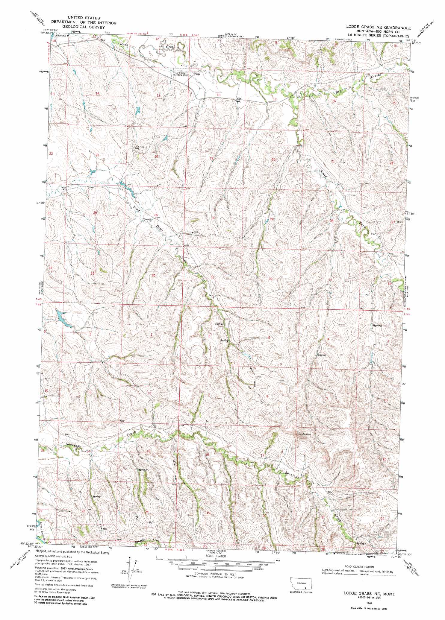
USGS Topo Quad 45107d3 - 1:24,000 scale
| Topo Map Name: | Lodge Grass Ne |
| USGS Topo Quad ID: | 45107d3 |
| Print Size: | ca. 21 1/4" wide x 27" high |
| Southeast Coordinates: | 45.375° N latitude / 107.25° W longitude |
| Map Center Coordinates: | 45.4375° N latitude / 107.3125° W longitude |
| U.S. State: | MT |
| Filename: | o45107d3.jpg |
| Download Map JPG Image: | Lodge Grass Ne topo map 1:24,000 scale |
| Map Type: | Topographic |
| Topo Series: | 7.5´ |
| Map Scale: | 1:24,000 |
| Source of Map Images: | United States Geological Survey (USGS) |
| Alternate Map Versions: |
Lodge Grass NE MT 1967, updated 1971 Download PDF Buy paper map Lodge Grass NE MT 1967, updated 1986 Download PDF Buy paper map Lodge Grass NE MT 1967, updated 1988 Download PDF Buy paper map Lodge Grass NE MT 2011 Download PDF Buy paper map Lodge Grass NE MT 2014 Download PDF Buy paper map |
1:24,000 Topo Quads surrounding Lodge Grass Ne
Hardin |
Little Dry Creek |
Crow Agency Ne |
Jeans Fork Nw |
Jeans Fork Ne |
Prante Ranch |
Crow Agency |
Crow Agency Se |
Jeans Fork Sw |
Jeans Fork Se |
Saint Xavier Ne |
Benteen |
Lodge Grass Ne |
Thompson Creek Nw |
Thompson Creek |
Shick Ranch |
Good Luck Creek |
Lodge Grass |
Wolf Mountain Lookout |
Spring Creek Ranch |
Willow Creek Dam |
Wyola |
Wyola Ne |
Kid Creek |
Bar V Ranch Ne |
> Back to 45107a1 at 1:100,000 scale
> Back to 45106a1 at 1:250,000 scale
> Back to U.S. Topo Maps home
Lodge Grass Ne topo map: Gazetteer
Lodge Grass Ne: Dams
Jeffers Number 1 Dam elevation 1003m 3290′Lodge Grass Ne: Streams
South Fork Reno Creek elevation 994m 3261′Lodge Grass Ne: Wells
04S35E12CDCA01 Well elevation 977m 3205′04S36E18AADC01 Well elevation 995m 3264′
04S36E18BABC01 Well elevation 988m 3241′
04S36E18BCDD01 Well elevation 997m 3270′
04S36E18DBBA01 Well elevation 1006m 3300′
05S35E14CBBA01 Well elevation 1008m 3307′
Lodge Grass Ne digital topo map on disk
Buy this Lodge Grass Ne topo map showing relief, roads, GPS coordinates and other geographical features, as a high-resolution digital map file on DVD:
Eastern Montana & Western North Dakota
Buy digital topo maps: Eastern Montana & Western North Dakota