Jeans Fork Nw Topo Map Montana
To zoom in, hover over the map of Jeans Fork Nw
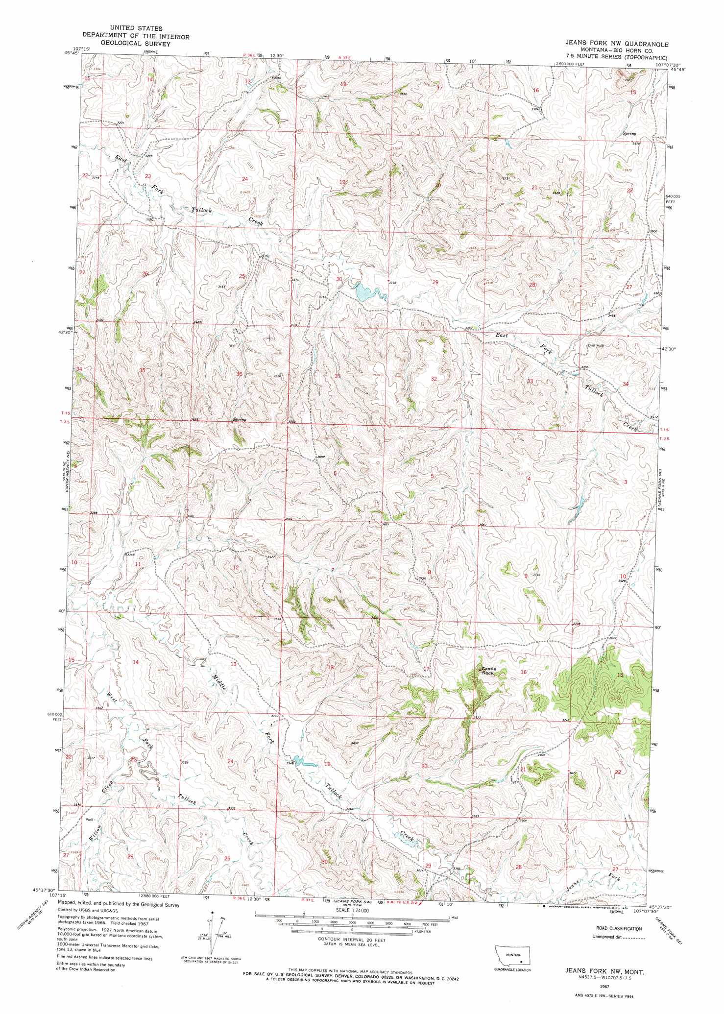
USGS Topo Quad 45107f2 - 1:24,000 scale
| Topo Map Name: | Jeans Fork Nw |
| USGS Topo Quad ID: | 45107f2 |
| Print Size: | ca. 21 1/4" wide x 27" high |
| Southeast Coordinates: | 45.625° N latitude / 107.125° W longitude |
| Map Center Coordinates: | 45.6875° N latitude / 107.1875° W longitude |
| U.S. State: | MT |
| Filename: | o45107f2.jpg |
| Download Map JPG Image: | Jeans Fork Nw topo map 1:24,000 scale |
| Map Type: | Topographic |
| Topo Series: | 7.5´ |
| Map Scale: | 1:24,000 |
| Source of Map Images: | United States Geological Survey (USGS) |
| Alternate Map Versions: |
Jeans Fork NW MT 1967, updated 1970 Download PDF Buy paper map Jeans Fork NW MT 2011 Download PDF Buy paper map Jeans Fork NW MT 2014 Download PDF Buy paper map |
1:24,000 Topo Quads surrounding Jeans Fork Nw
Dudley Spring |
Hammond Ranch |
Iron Spring |
Minnehaha Creek South |
Mcclure Creek |
The Dugout |
Padlock Ranch |
Iron Spring Sw |
Wolf School |
Sarpy School |
Little Dry Creek |
Crow Agency Ne |
Jeans Fork Nw |
Jeans Fork Ne |
Chalky Point |
Crow Agency |
Crow Agency Se |
Jeans Fork Sw |
Jeans Fork Se |
Busby |
Benteen |
Lodge Grass Ne |
Thompson Creek Nw |
Thompson Creek |
Birdseye Spring |
> Back to 45107e1 at 1:100,000 scale
> Back to 45106a1 at 1:250,000 scale
> Back to U.S. Topo Maps home
Jeans Fork Nw topo map: Gazetteer
Jeans Fork Nw: Dams
Forgotton Dam elevation 1031m 3382′Tommy Tee Dam elevation 1011m 3316′
Jeans Fork Nw: Streams
Willow Creek elevation 1007m 3303′Jeans Fork Nw: Summits
Castle Rock elevation 1173m 3848′Jeans Fork Nw digital topo map on disk
Buy this Jeans Fork Nw topo map showing relief, roads, GPS coordinates and other geographical features, as a high-resolution digital map file on DVD:
Eastern Montana & Western North Dakota
Buy digital topo maps: Eastern Montana & Western North Dakota