Crow Agency Ne Topo Map Montana
To zoom in, hover over the map of Crow Agency Ne
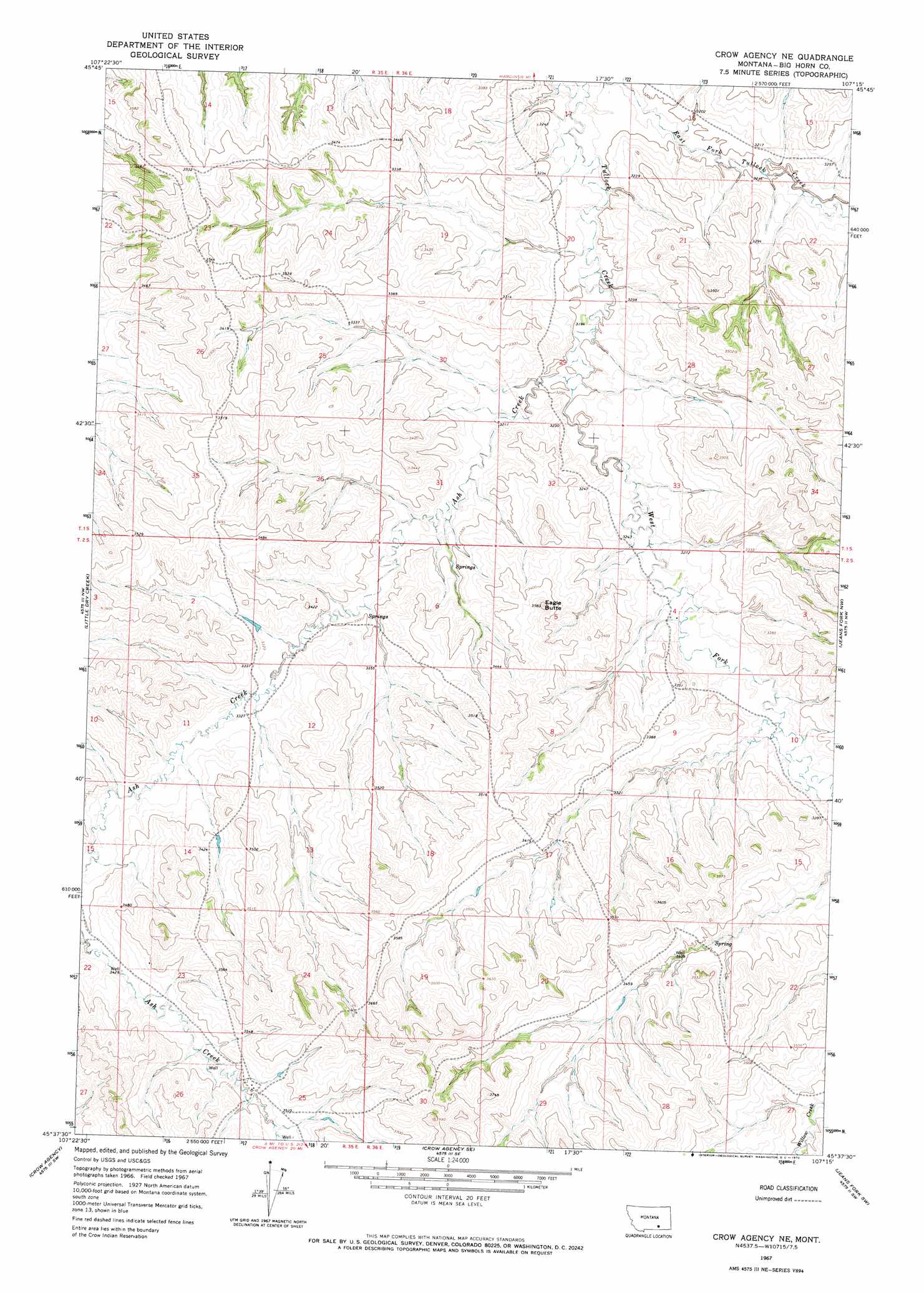
USGS Topo Quad 45107f3 - 1:24,000 scale
| Topo Map Name: | Crow Agency Ne |
| USGS Topo Quad ID: | 45107f3 |
| Print Size: | ca. 21 1/4" wide x 27" high |
| Southeast Coordinates: | 45.625° N latitude / 107.25° W longitude |
| Map Center Coordinates: | 45.6875° N latitude / 107.3125° W longitude |
| U.S. State: | MT |
| Filename: | o45107f3.jpg |
| Download Map JPG Image: | Crow Agency Ne topo map 1:24,000 scale |
| Map Type: | Topographic |
| Topo Series: | 7.5´ |
| Map Scale: | 1:24,000 |
| Source of Map Images: | United States Geological Survey (USGS) |
| Alternate Map Versions: |
Crow Agency NE MT 1967, updated 1970 Download PDF Buy paper map Crow Agency NE MT 2011 Download PDF Buy paper map Crow Agency NE MT 2014 Download PDF Buy paper map |
1:24,000 Topo Quads surrounding Crow Agency Ne
Foster |
Dudley Spring |
Hammond Ranch |
Iron Spring |
Minnehaha Creek South |
Ninemile Point |
The Dugout |
Padlock Ranch |
Iron Spring Sw |
Wolf School |
Hardin |
Little Dry Creek |
Crow Agency Ne |
Jeans Fork Nw |
Jeans Fork Ne |
Prante Ranch |
Crow Agency |
Crow Agency Se |
Jeans Fork Sw |
Jeans Fork Se |
Saint Xavier Ne |
Benteen |
Lodge Grass Ne |
Thompson Creek Nw |
Thompson Creek |
> Back to 45107e1 at 1:100,000 scale
> Back to 45106a1 at 1:250,000 scale
> Back to U.S. Topo Maps home
Crow Agency Ne topo map: Gazetteer
Crow Agency Ne: Streams
Ash Creek elevation 976m 3202′Middle Fork Tullock Creek elevation 994m 3261′
West Fork Tullock Creek elevation 970m 3182′
Crow Agency Ne: Summits
Eagle Butte elevation 1081m 3546′Crow Agency Ne digital topo map on disk
Buy this Crow Agency Ne topo map showing relief, roads, GPS coordinates and other geographical features, as a high-resolution digital map file on DVD:
Eastern Montana & Western North Dakota
Buy digital topo maps: Eastern Montana & Western North Dakota