Rowley Nw Topo Map Montana
To zoom in, hover over the map of Rowley Nw
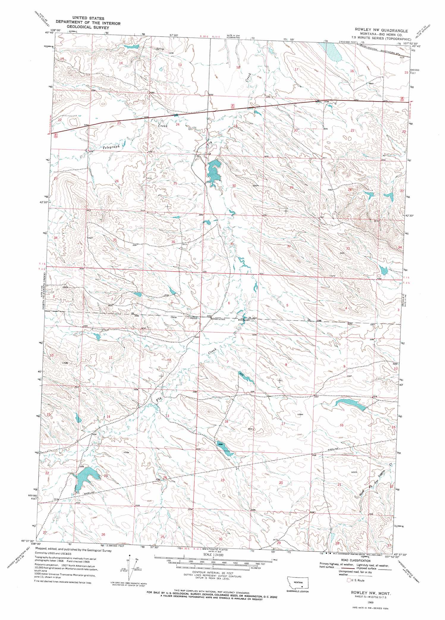
USGS Topo Quad 45107f8 - 1:24,000 scale
| Topo Map Name: | Rowley Nw |
| USGS Topo Quad ID: | 45107f8 |
| Print Size: | ca. 21 1/4" wide x 27" high |
| Southeast Coordinates: | 45.625° N latitude / 107.875° W longitude |
| Map Center Coordinates: | 45.6875° N latitude / 107.9375° W longitude |
| U.S. State: | MT |
| Filename: | o45107f8.jpg |
| Download Map JPG Image: | Rowley Nw topo map 1:24,000 scale |
| Map Type: | Topographic |
| Topo Series: | 7.5´ |
| Map Scale: | 1:24,000 |
| Source of Map Images: | United States Geological Survey (USGS) |
| Alternate Map Versions: |
Rowley NW MT 1969, updated 1972 Download PDF Buy paper map Rowley NW MT 2011 Download PDF Buy paper map Rowley NW MT 2014 Download PDF Buy paper map |
1:24,000 Topo Quads surrounding Rowley Nw
Worden |
Nibbe |
Pompeys Pillar |
Wagon Box Spring |
Lemon Ranch |
Indian Arrow |
Gails Coulee |
Corinth |
Blue Spring |
Chimney Creek |
Woody Mountain Nw |
North Telegraph Creek |
Rowley Nw |
Rowley |
Walker Hill |
Woody Mountain |
Woody Mountain Se |
Bentonite Flats |
Woody Creek Camp |
Hardin Sw |
Bear Coulee |
Mott Creek |
Camp Four |
Lemonade Springs |
Saint Xavier |
> Back to 45107e1 at 1:100,000 scale
> Back to 45106a1 at 1:250,000 scale
> Back to U.S. Topo Maps home
Rowley Nw topo map: Gazetteer
Rowley Nw: Dams
Christensen L and C Number 1 Dam elevation 999m 3277′Crow Number 16 Dam elevation 1001m 3284′
J R Scott Number 1 Dam elevation 974m 3195′
J R Scott Number 5 Dam elevation 998m 3274′
J R Scott Number 8 Dam elevation 1011m 3316′
J R Scott Number 9 Dam elevation 1013m 3323′
Kjeldgaard Number 2 Dam elevation 1003m 3290′
R Downs Number 7 Dam elevation 984m 3228′
Rowley Nw: Streams
North Telegraph Creek elevation 996m 3267′Telegraph Creek elevation 976m 3202′
Rowley Nw digital topo map on disk
Buy this Rowley Nw topo map showing relief, roads, GPS coordinates and other geographical features, as a high-resolution digital map file on DVD:
Eastern Montana & Western North Dakota
Buy digital topo maps: Eastern Montana & Western North Dakota