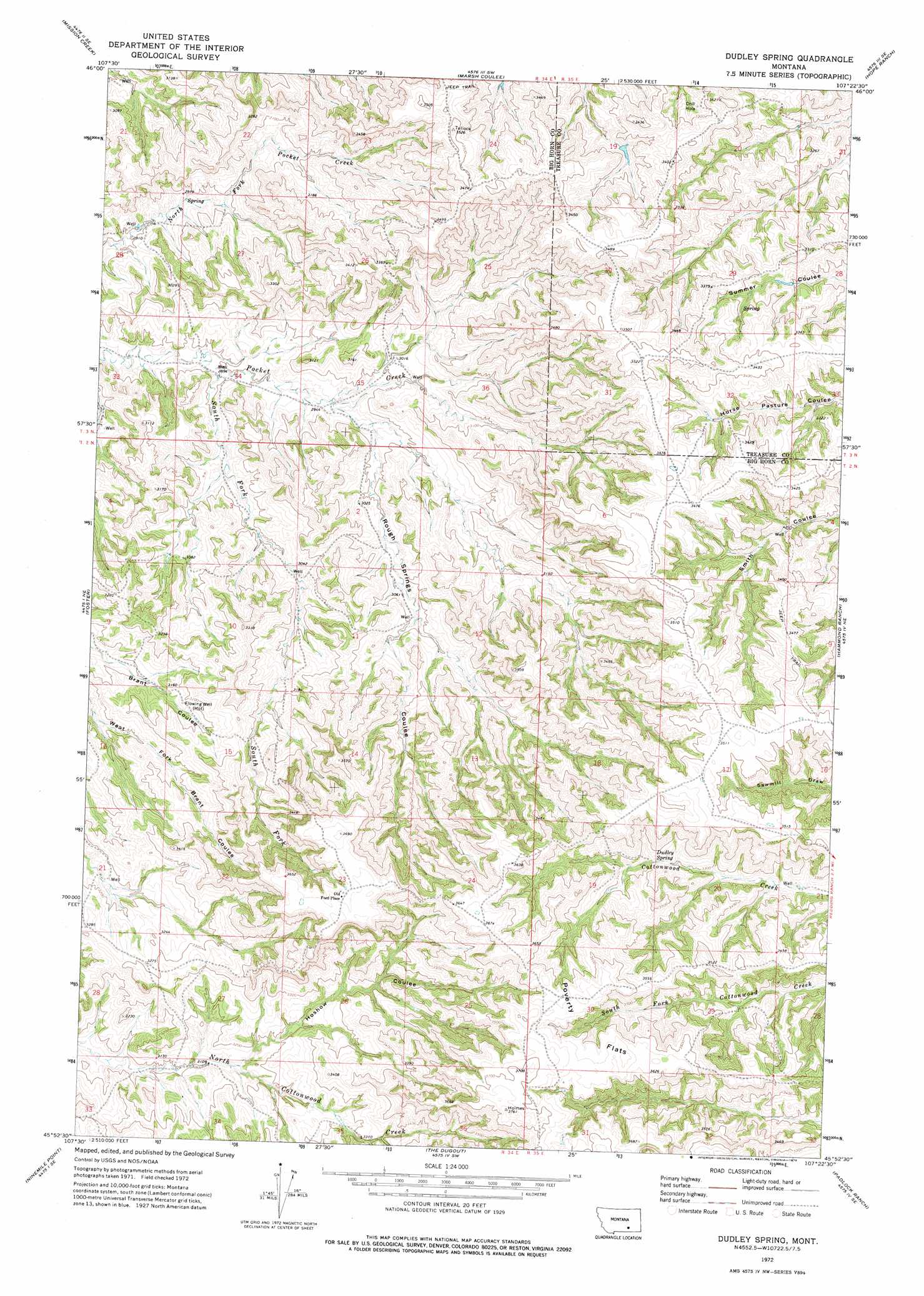
Dudley Spring Topo Map Montana
To zoom in, hover over the map of Dudley Spring
USGS Topo Quad 45107h4 - 1:24,000 scale
| Topo Map Name: | Dudley Spring |
| USGS Topo Quad ID: | 45107h4 |
| Print Size: | ca. 21 1/4" wide x 27" high |
| Southeast Coordinates: | 45.875° N latitude / 107.375° W longitude |
| Map Center Coordinates: | 45.9375° N latitude / 107.4375° W longitude |
| U.S. State: | MT |
| Filename: | o45107h4.jpg |
| Download Map JPG Image: | Dudley Spring topo map 1:24,000 scale |
| Map Type: | Topographic |
| Topo Series: | 7.5´ |
| Map Scale: | 1:24,000 |
| Source of Map Images: | United States Geological Survey (USGS) |
| Alternate Map Versions: |
Dudley Spring MT 1972, updated 1976 Download PDF Buy paper map Dudley Spring MT 2011 Download PDF Buy paper map Dudley Spring MT 2014 Download PDF Buy paper map |
1:24,000 Topo Quads surrounding Dudley Spring
Coal Bank Creek |
Custer |
Bighorn |
Eldering Ranch |
Scraper Coulee |
Waco |
Mission Creek |
Marsh Coulee |
Hope Ranch |
South Bear Creek |
Lemon Ranch |
Foster |
Dudley Spring |
Hammond Ranch |
Iron Spring |
Chimney Creek |
Ninemile Point |
The Dugout |
Padlock Ranch |
Iron Spring Sw |
Walker Hill |
Hardin |
Little Dry Creek |
Crow Agency Ne |
Jeans Fork Nw |
> Back to 45107e1 at 1:100,000 scale
> Back to 45106a1 at 1:250,000 scale
> Back to U.S. Topo Maps home
Dudley Spring topo map: Gazetteer
Dudley Spring: Flats
Poverty Flats elevation 1114m 3654′Dudley Spring: Populated Places
Old Ford Place elevation 1114m 3654′Dudley Spring: Springs
Dudley Spring elevation 1011m 3316′Dudley Spring: Streams
South Fork Pocket Creek elevation 876m 2874′Dudley Spring: Valleys
Hoshow Coulee elevation 955m 3133′Rough Springs Coulee elevation 903m 2962′
Dudley Spring: Wells
02N34E02CACD01 Well elevation 956m 3136′Dudley Spring digital topo map on disk
Buy this Dudley Spring topo map showing relief, roads, GPS coordinates and other geographical features, as a high-resolution digital map file on DVD:
Eastern Montana & Western North Dakota
Buy digital topo maps: Eastern Montana & Western North Dakota