Bear Canyon Topo Map Montana
To zoom in, hover over the map of Bear Canyon
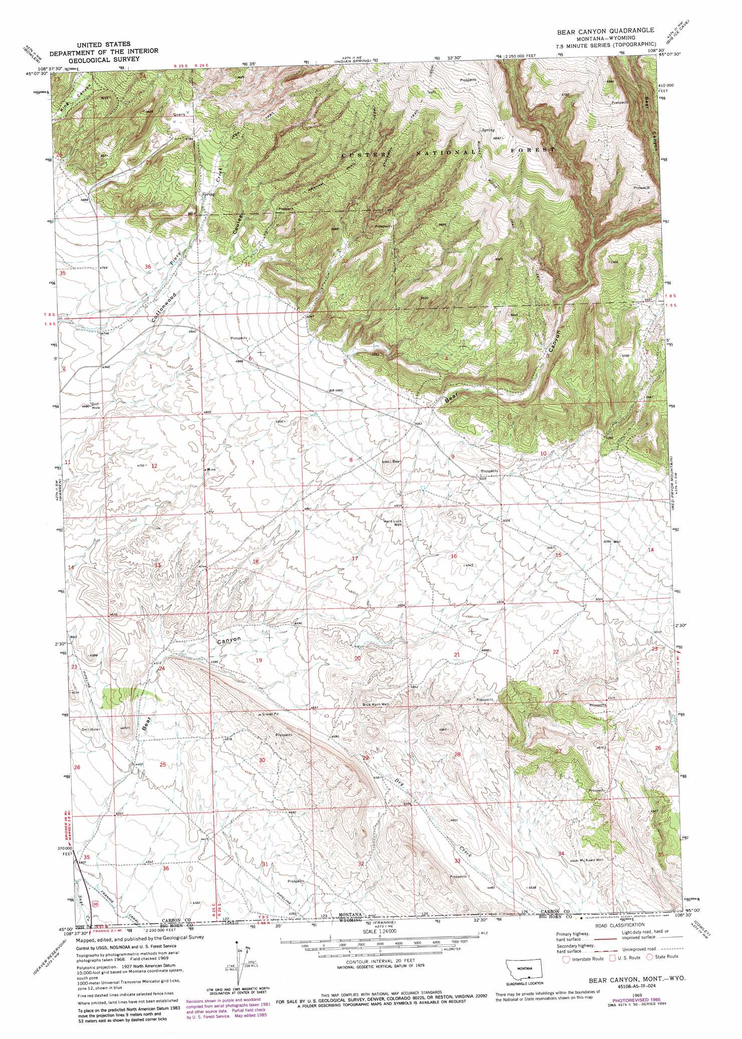
USGS Topo Quad 45108a5 - 1:24,000 scale
| Topo Map Name: | Bear Canyon |
| USGS Topo Quad ID: | 45108a5 |
| Print Size: | ca. 21 1/4" wide x 27" high |
| Southeast Coordinates: | 45° N latitude / 108.5° W longitude |
| Map Center Coordinates: | 45.0625° N latitude / 108.5625° W longitude |
| U.S. States: | MT, WY |
| Filename: | o45108a5.jpg |
| Download Map JPG Image: | Bear Canyon topo map 1:24,000 scale |
| Map Type: | Topographic |
| Topo Series: | 7.5´ |
| Map Scale: | 1:24,000 |
| Source of Map Images: | United States Geological Survey (USGS) |
| Alternate Map Versions: |
Bear Canyon MT 1969, updated 1973 Download PDF Buy paper map Bear Canyon MT 1969, updated 1986 Download PDF Buy paper map Bear Canyon MT 1996, updated 1999 Download PDF Buy paper map Bear Canyon MT 2011 Download PDF Buy paper map Bear Canyon MT 2014 Download PDF Buy paper map |
| FStopo: | US Forest Service topo Bear Canyon is available: Download FStopo PDF Download FStopo TIF |
1:24,000 Topo Quads surrounding Bear Canyon
Bluewater |
Section House Draw |
Castle Rocks |
Deep Creek Sw |
Deep Creek Se |
Wade |
Bowler |
Indian Spring |
Big Ice Cave |
East Pryor Mountain |
Hunters Creek |
Warren |
Bear Canyon |
Red Pryor Mountain |
Mystery Cave |
Elk Basin |
Deaver Reservoir |
Frannie |
Cowley |
Sykes Spring |
Elk Basin Se |
Garland |
Byron |
Lovell |
Lovell Lakes |
> Back to 45108a1 at 1:100,000 scale
> Back to 45108a1 at 1:250,000 scale
> Back to U.S. Topo Maps home
Bear Canyon topo map: Gazetteer
Bear Canyon: Canals
Frannie Canal elevation 1310m 4297′Bear Canyon: Dams
Southside Detention Dam elevation 1458m 4783′Bear Canyon: Streams
Bear Creek elevation 1310m 4297′Bear Canyon: Trails
Burnt Ridge Trail elevation 1883m 6177′Graham Trail elevation 1774m 5820′
Piney Creek Trail elevation 1763m 5784′
Stockman Trail elevation 2020m 6627′
Bear Canyon: Valleys
Bear Canyon elevation 1315m 4314′Bear Canyon: Wells
08S25E25AACB01 Well elevation 1568m 5144′09S25E13DAAD01 Well elevation 1447m 4747′
09S26E09DACB01 Well elevation 1532m 5026′
09S26E15CAAC01 Well elevation 1530m 5019′
09S26E20DDCC01 Well elevation 1465m 4806′
Blue Wash Well elevation 1469m 4819′
Hard Luck Well elevation 1502m 4927′
McKnown Well elevation 1385m 4543′
Bear Canyon digital topo map on disk
Buy this Bear Canyon topo map showing relief, roads, GPS coordinates and other geographical features, as a high-resolution digital map file on DVD: