Deep Creek Sw Topo Map Montana
To zoom in, hover over the map of Deep Creek Sw
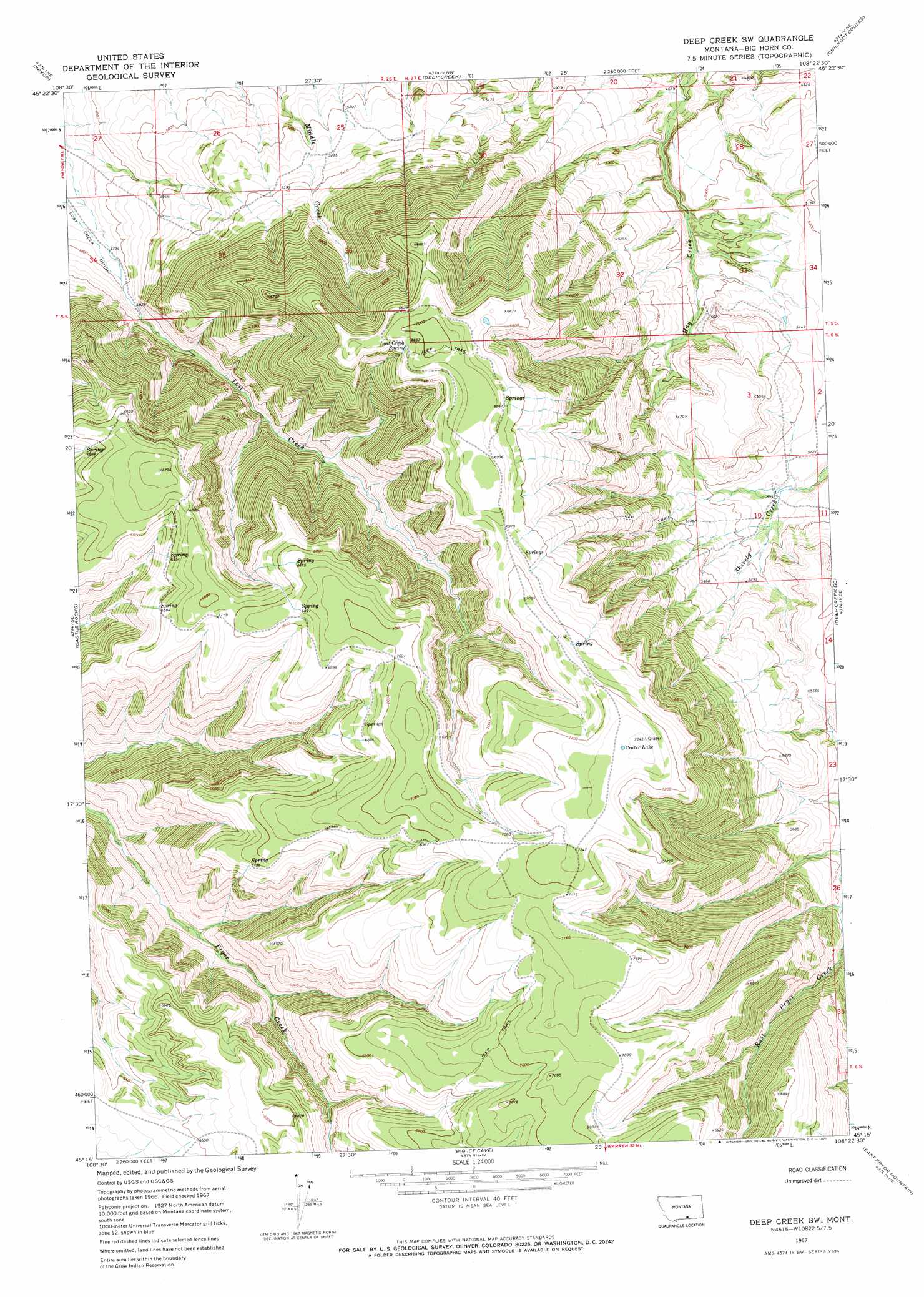
USGS Topo Quad 45108c4 - 1:24,000 scale
| Topo Map Name: | Deep Creek Sw |
| USGS Topo Quad ID: | 45108c4 |
| Print Size: | ca. 21 1/4" wide x 27" high |
| Southeast Coordinates: | 45.25° N latitude / 108.375° W longitude |
| Map Center Coordinates: | 45.3125° N latitude / 108.4375° W longitude |
| U.S. State: | MT |
| Filename: | o45108c4.jpg |
| Download Map JPG Image: | Deep Creek Sw topo map 1:24,000 scale |
| Map Type: | Topographic |
| Topo Series: | 7.5´ |
| Map Scale: | 1:24,000 |
| Source of Map Images: | United States Geological Survey (USGS) |
| Alternate Map Versions: |
Deep Creek SW MT 1967, updated 1971 Download PDF Buy paper map Deep Creek SW MT 2011 Download PDF Buy paper map Deep Creek SW MT 2014 Download PDF Buy paper map |
1:24,000 Topo Quads surrounding Deep Creek Sw
Mossmain Sw |
Stratford Hill |
Vale Creek Ranch |
Soda Springs |
Woody Mountain |
Pryor Nw |
Pryor |
Deep Creek |
Chilkoot Coulee |
Bear Coulee |
Section House Draw |
Castle Rocks |
Deep Creek Sw |
Deep Creek Se |
Bear Coulee Sw |
Bowler |
Indian Spring |
Big Ice Cave |
East Pryor Mountain |
Dead Indian Hill |
Warren |
Bear Canyon |
Red Pryor Mountain |
Mystery Cave |
Hillsboro |
> Back to 45108a1 at 1:100,000 scale
> Back to 45108a1 at 1:250,000 scale
> Back to U.S. Topo Maps home
Deep Creek Sw topo map: Gazetteer
Deep Creek Sw: Lakes
Crater Lake elevation 2229m 7312′Deep Creek Sw: Springs
Lost Creek Spring elevation 2109m 6919′Deep Creek Sw digital topo map on disk
Buy this Deep Creek Sw topo map showing relief, roads, GPS coordinates and other geographical features, as a high-resolution digital map file on DVD: