Deep Creek Topo Map Montana
To zoom in, hover over the map of Deep Creek
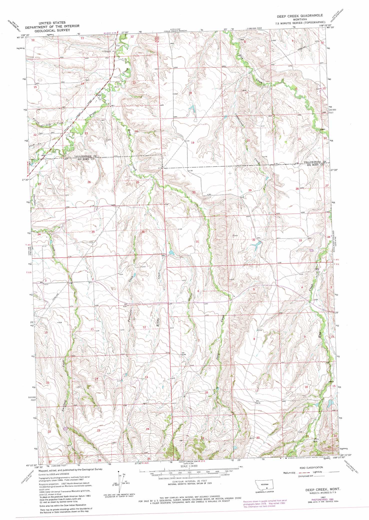
USGS Topo Quad 45108d4 - 1:24,000 scale
| Topo Map Name: | Deep Creek |
| USGS Topo Quad ID: | 45108d4 |
| Print Size: | ca. 21 1/4" wide x 27" high |
| Southeast Coordinates: | 45.375° N latitude / 108.375° W longitude |
| Map Center Coordinates: | 45.4375° N latitude / 108.4375° W longitude |
| U.S. State: | MT |
| Filename: | o45108d4.jpg |
| Download Map JPG Image: | Deep Creek topo map 1:24,000 scale |
| Map Type: | Topographic |
| Topo Series: | 7.5´ |
| Map Scale: | 1:24,000 |
| Source of Map Images: | United States Geological Survey (USGS) |
| Alternate Map Versions: |
Deep Creek MT 1967, updated 1971 Download PDF Buy paper map Deep Creek MT 1967, updated 1972 Download PDF Buy paper map Deep Creek MT 1967, updated 1980 Download PDF Buy paper map Deep Creek MT 2011 Download PDF Buy paper map Deep Creek MT 2014 Download PDF Buy paper map |
1:24,000 Topo Quads surrounding Deep Creek
Mossmain |
Yegen |
Soda Springs Nw |
Badbaby Coulee |
Woody Mountain Nw |
Mossmain Sw |
Stratford Hill |
Vale Creek Ranch |
Soda Springs |
Woody Mountain |
Pryor Nw |
Pryor |
Deep Creek |
Chilkoot Coulee |
Bear Coulee |
Section House Draw |
Castle Rocks |
Deep Creek Sw |
Deep Creek Se |
Bear Coulee Sw |
Bowler |
Indian Spring |
Big Ice Cave |
East Pryor Mountain |
Dead Indian Hill |
> Back to 45108a1 at 1:100,000 scale
> Back to 45108a1 at 1:250,000 scale
> Back to U.S. Topo Maps home
Deep Creek topo map: Gazetteer
Deep Creek: Dams
Gc Lande Number 1 Dam elevation 1366m 4481′Deep Creek: Streams
Cottonwood Creek elevation 1176m 3858′Deep Creek elevation 1165m 3822′
Fourth of July Creek elevation 1175m 3854′
Middle Creek elevation 1200m 3937′
Plum Creek elevation 1186m 3891′
Porcupine Creek elevation 1215m 3986′
Smallpox Creek elevation 1184m 3884′
Deep Creek: Wells
04S26E13BCBC01 Well elevation 1164m 3818′05S27E15BCBB01 Well elevation 1326m 4350′
Deep Creek digital topo map on disk
Buy this Deep Creek topo map showing relief, roads, GPS coordinates and other geographical features, as a high-resolution digital map file on DVD: