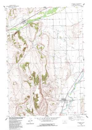
Fromberg Topo Map Montana
To zoom in, hover over the map of Fromberg
USGS Topo Quad 45108d8 - 1:24,000 scale
| Topo Map Name: | Fromberg |
| USGS Topo Quad ID: | 45108d8 |
| Print Size: | ca. 21 1/4" wide x 27" high |
| Southeast Coordinates: | 45.375° N latitude / 108.875° W longitude |
| Map Center Coordinates: | 45.4375° N latitude / 108.9375° W longitude |
| U.S. State: | MT |
| Filename: | o45108d8.jpg |
| Download Map JPG Image: | Fromberg topo map 1:24,000 scale |
| Map Type: | Topographic |
| Topo Series: | 7.5´ |
| Map Scale: | 1:24,000 |
| Source of Map Images: | United States Geological Survey (USGS) |
| Alternate Map Versions: |
Fromberg MT 1956, updated 1958 Download PDF Buy paper map Fromberg MT 1956, updated 1992 Download PDF Buy paper map Fromberg MT 2011 Download PDF Buy paper map Fromberg MT 2014 Download PDF Buy paper map |
1:24,000 Topo Quads surrounding Fromberg
> Back to 45108a1 at 1:100,000 scale
> Back to 45108a1 at 1:250,000 scale
> Back to U.S. Topo Maps home
Fromberg topo map: Gazetteer
Fromberg: Bridges
Clarks Fork of the Yellowstone Bridge elevation 1073m 3520′Elbow Creek Bridge elevation 1069m 3507′
Fromberg: Canals
Bartlett Canal elevation 1081m 3546′Carbon Canal elevation 1114m 3654′
Dickey Ditch elevation 1101m 3612′
Duffield Ditch elevation 1157m 3795′
East Elbow Ditch elevation 1102m 3615′
First Chance Ditch elevation 1094m 3589′
Granite Ditch elevation 1105m 3625′
Joliet Ditch elevation 1141m 3743′
Last Chance Ditch elevation 1122m 3681′
Prosperity-Granite Ditch elevation 1102m 3615′
West Elbow Ditch elevation 1095m 3592′
Young-Pickering Ditch elevation 1105m 3625′
Fromberg: Dams
Lester Number 1 Dam elevation 1200m 3937′Schlemmer Number 1 Dam elevation 1066m 3497′
Fromberg: Parks
Fromberg City Park elevation 1077m 3533′Joliet City Park elevation 1139m 3736′
Fromberg: Populated Places
Berts Trailer Court elevation 1077m 3533′Coalville (historical) elevation 1131m 3710′
Fromberg elevation 1077m 3533′
Joliet elevation 1139m 3736′
Stones Trailer Park elevation 1246m 4087′
Fromberg: Post Offices
Coalville Post Office (historical) elevation 1131m 3710′Fromberg Post Office elevation 1079m 3540′
Joliet Post Office elevation 1139m 3736′
Fromberg: Streams
Bluewater Creek elevation 1077m 3533′Hot Dance Creek elevation 1157m 3795′
Fromberg: Wells
04S22E10DDAC01 Well elevation 1197m 3927′04S22E24CCDC01 Well elevation 1192m 3910′
04S22E25CABA01 Well elevation 1144m 3753′
04S23E18ADCD01 Well elevation 1116m 3661′
04S23E27CBCB01 Well elevation 1074m 3523′
04S23E29CCCB01 Well elevation 1113m 3651′
04S23E31ADCD01 Well elevation 1126m 3694′
04S23E32BBCD01 Well elevation 1125m 3690′
04S23E33BAAD01 Well elevation 1079m 3540′
04S23E33CACD01 Well elevation 1083m 3553′
05S22E03BADB01 Well elevation 1193m 3914′
05S23E04ADDA01 Well elevation 1073m 3520′
05S23E09AABD01 Well elevation 1064m 3490′
05S23E16DDCC01 Well elevation 1082m 3549′
05S23E17DCCA01 Well elevation 1081m 3546′
05S23E20DAAD01 Well elevation 1080m 3543′
05S23E22BCBC01 Well elevation 1100m 3608′
Fromberg digital topo map on disk
Buy this Fromberg topo map showing relief, roads, GPS coordinates and other geographical features, as a high-resolution digital map file on DVD:


