Badbaby Coulee Topo Map Montana
To zoom in, hover over the map of Badbaby Coulee
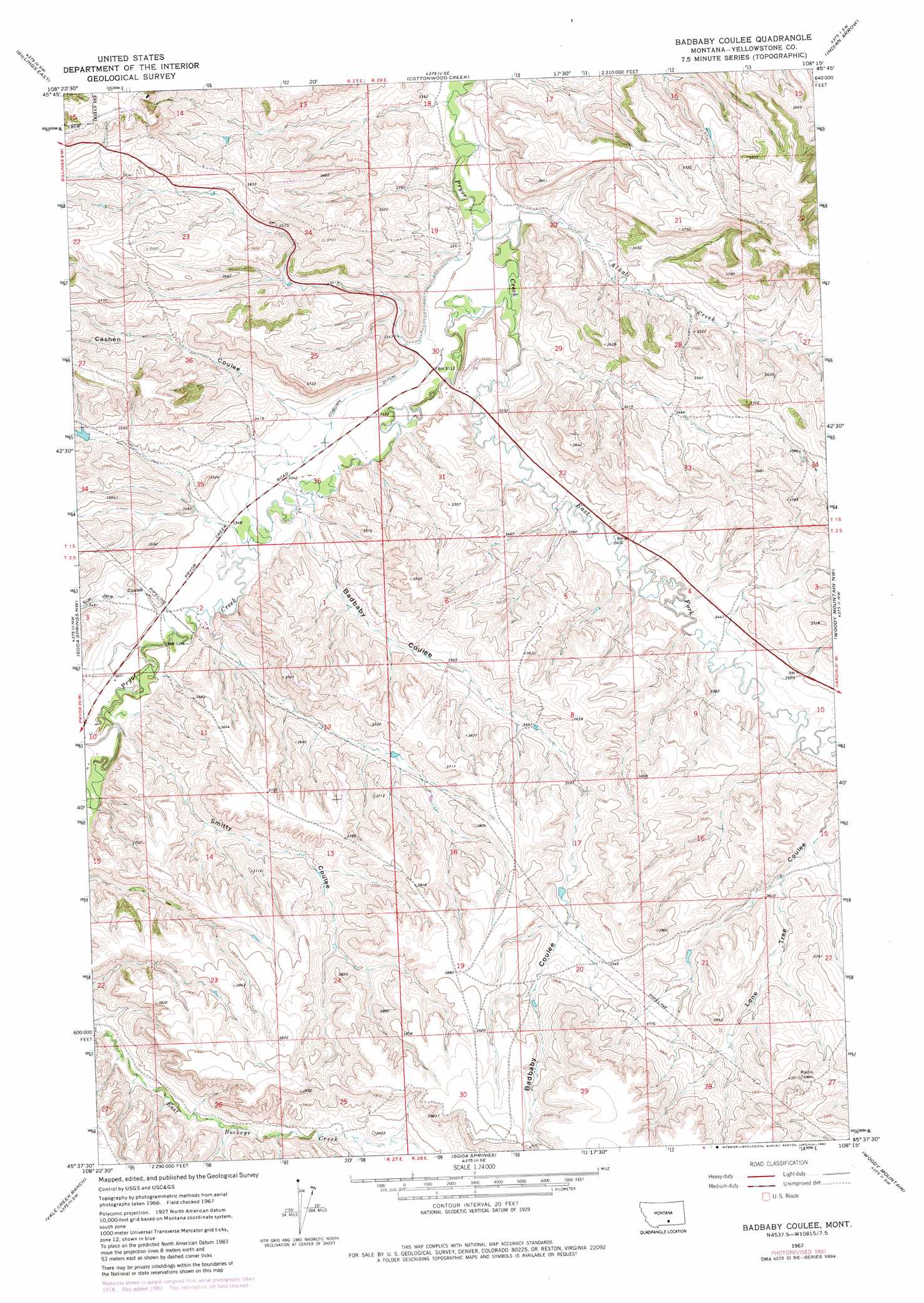
USGS Topo Quad 45108f3 - 1:24,000 scale
| Topo Map Name: | Badbaby Coulee |
| USGS Topo Quad ID: | 45108f3 |
| Print Size: | ca. 21 1/4" wide x 27" high |
| Southeast Coordinates: | 45.625° N latitude / 108.25° W longitude |
| Map Center Coordinates: | 45.6875° N latitude / 108.3125° W longitude |
| U.S. State: | MT |
| Filename: | o45108f3.jpg |
| Download Map JPG Image: | Badbaby Coulee topo map 1:24,000 scale |
| Map Type: | Topographic |
| Topo Series: | 7.5´ |
| Map Scale: | 1:24,000 |
| Source of Map Images: | United States Geological Survey (USGS) |
| Alternate Map Versions: |
Badbaby Coulee MT 1967, updated 1972 Download PDF Buy paper map Badbaby Coulee MT 1967, updated 1980 Download PDF Buy paper map Badbaby Coulee MT 2011 Download PDF Buy paper map Badbaby Coulee MT 2014 Download PDF Buy paper map |
1:24,000 Topo Quads surrounding Badbaby Coulee
Hickson Ranch |
Rattlesnake Butte |
Huntley |
Worden |
Nibbe |
Billings West |
Billings East |
Cottonwood Creek |
Indian Arrow |
Gails Coulee |
Yegen |
Soda Springs Nw |
Badbaby Coulee |
Woody Mountain Nw |
North Telegraph Creek |
Stratford Hill |
Vale Creek Ranch |
Soda Springs |
Woody Mountain |
Woody Mountain Se |
Pryor |
Deep Creek |
Chilkoot Coulee |
Bear Coulee |
Mott Creek |
> Back to 45108e1 at 1:100,000 scale
> Back to 45108a1 at 1:250,000 scale
> Back to U.S. Topo Maps home
Badbaby Coulee topo map: Gazetteer
Badbaby Coulee: Canals
Coburn Ditch elevation 1020m 3346′Badbaby Coulee: Dams
S and S Kurth Number 1 Dam elevation 1082m 3549′Badbaby Coulee: Streams
Alkali Creek elevation 1001m 3284′East Fork Pryor Creek elevation 1003m 3290′
Badbaby Coulee: Valleys
Badbaby Coulee elevation 1024m 3359′Cashen Coulee elevation 1034m 3392′
Smitty Coulee elevation 1037m 3402′
Sue Jane Coulee elevation 1038m 3405′
Badbaby Coulee: Wells
01S27E36ADBB01 Well elevation 1013m 3323′Badbaby Coulee digital topo map on disk
Buy this Badbaby Coulee topo map showing relief, roads, GPS coordinates and other geographical features, as a high-resolution digital map file on DVD: