Yegen Topo Map Montana
To zoom in, hover over the map of Yegen
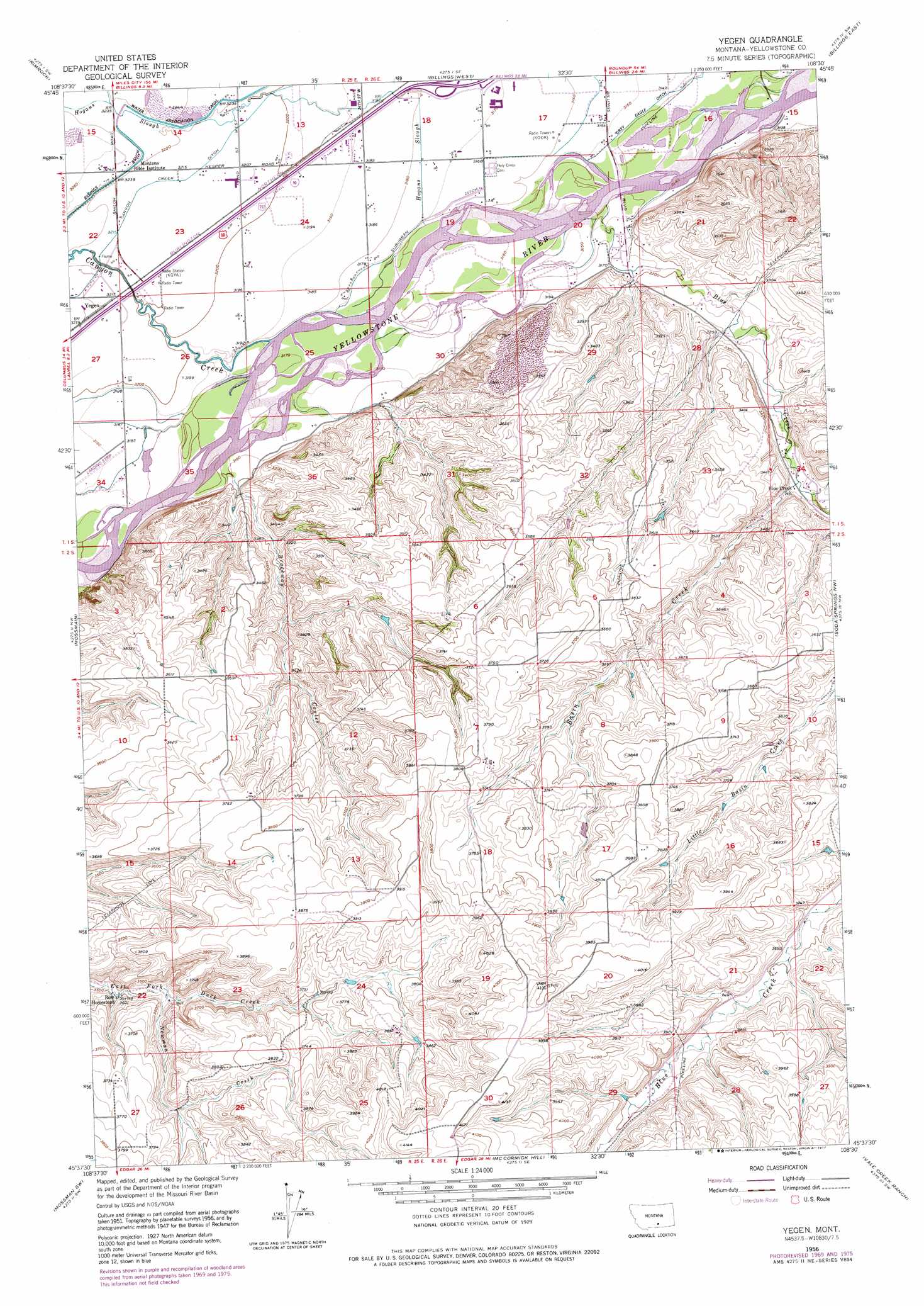
USGS Topo Quad 45108f5 - 1:24,000 scale
| Topo Map Name: | Yegen |
| USGS Topo Quad ID: | 45108f5 |
| Print Size: | ca. 21 1/4" wide x 27" high |
| Southeast Coordinates: | 45.625° N latitude / 108.5° W longitude |
| Map Center Coordinates: | 45.6875° N latitude / 108.5625° W longitude |
| U.S. State: | MT |
| Filename: | o45108f5.jpg |
| Download Map JPG Image: | Yegen topo map 1:24,000 scale |
| Map Type: | Topographic |
| Topo Series: | 7.5´ |
| Map Scale: | 1:24,000 |
| Source of Map Images: | United States Geological Survey (USGS) |
| Alternate Map Versions: |
Yegen MT 1956, updated 1958 Download PDF Buy paper map Yegen MT 1956, updated 1970 Download PDF Buy paper map Yegen MT 1956, updated 1975 Download PDF Buy paper map Yegen MT 1956, updated 1977 Download PDF Buy paper map Yegen MT 2011 Download PDF Buy paper map Yegen MT 2014 Download PDF Buy paper map |
1:24,000 Topo Quads surrounding Yegen
Comanche |
Acton |
Hickson Ranch |
Rattlesnake Butte |
Huntley |
Two Pine School |
Rimrock |
Billings West |
Billings East |
Cottonwood Creek |
Laurel |
Mossmain |
Yegen |
Soda Springs Nw |
Badbaby Coulee |
Silesia |
Mossmain Sw |
Stratford Hill |
Vale Creek Ranch |
Soda Springs |
Edgar |
Pryor Nw |
Pryor |
Deep Creek |
Chilkoot Coulee |
> Back to 45108e1 at 1:100,000 scale
> Back to 45108a1 at 1:250,000 scale
> Back to U.S. Topo Maps home
Yegen topo map: Gazetteer
Yegen: Airports
Airpark Oscars elevation 973m 3192′Yegen: Canals
Suburban Ditch elevation 966m 3169′Yegen: Populated Places
Yegen elevation 982m 3221′Yegen: Streams
Basin Creek elevation 1014m 3326′Blue Creek elevation 958m 3143′
Canyon Creek elevation 967m 3172′
Hogans Slough elevation 964m 3162′
Newman Creek elevation 1077m 3533′
Yegen: Valleys
Brockway Coulee elevation 970m 3182′Yegen: Wells
01S25E13DACC01 Well elevation 974m 3195′01S25E22AAAA01 Well elevation 989m 3244′
01S25E23AAAC01 Well elevation 978m 3208′
01S25E26ADDB01 Well elevation 973m 3192′
01S25E26BBAA01 Well elevation 977m 3205′
01S25E35BBBC01 Well elevation 971m 3185′
01S26E16ADDA01 Well elevation 955m 3133′
01S26E17DCAB01 Well elevation 964m 3162′
01S26E18ACCD01 Well elevation 969m 3179′
01S26E19ADAB01 Well elevation 965m 3166′
01S26E19BCBB01 Well elevation 972m 3188′
01S26E20DDDA01 Well elevation 969m 3179′
01S26E28ACAC01 Well elevation 989m 3244′
01S26E28BACD01 Well elevation 992m 3254′
02S26E10BDCA01 Well elevation 1087m 3566′
Yegen digital topo map on disk
Buy this Yegen topo map showing relief, roads, GPS coordinates and other geographical features, as a high-resolution digital map file on DVD: