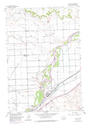
Huntley Topo Map Montana
To zoom in, hover over the map of Huntley
USGS Topo Quad 45108h3 - 1:24,000 scale
| Topo Map Name: | Huntley |
| USGS Topo Quad ID: | 45108h3 |
| Print Size: | ca. 21 1/4" wide x 27" high |
| Southeast Coordinates: | 45.875° N latitude / 108.25° W longitude |
| Map Center Coordinates: | 45.9375° N latitude / 108.3125° W longitude |
| U.S. State: | MT |
| Filename: | o45108h3.jpg |
| Download Map JPG Image: | Huntley topo map 1:24,000 scale |
| Map Type: | Topographic |
| Topo Series: | 7.5´ |
| Map Scale: | 1:24,000 |
| Source of Map Images: | United States Geological Survey (USGS) |
| Alternate Map Versions: |
Huntley MT 1956, updated 1958 Download PDF Buy paper map Huntley MT 1956, updated 1970 Download PDF Buy paper map Huntley MT 1956, updated 1977 Download PDF Buy paper map Huntley MT 2011 Download PDF Buy paper map Huntley MT 2014 Download PDF Buy paper map |
1:24,000 Topo Quads surrounding Huntley
> Back to 45108e1 at 1:100,000 scale
> Back to 45108a1 at 1:250,000 scale
> Back to U.S. Topo Maps home
Huntley topo map: Gazetteer
Huntley: Islands
Spraklin Island elevation 913m 2995′Huntley: Populated Places
Huntley elevation 921m 3021′Shepherd elevation 947m 3106′
Huntley: Streams
Crooked Creek elevation 907m 2975′Pryor Creek elevation 921m 3021′
Razor Creek elevation 907m 2975′
Twelve Mile Creek elevation 925m 3034′
Huntley: Summits
Deer Point elevation 996m 3267′Huntley: Wells
02N27E01AABA01 Well elevation 943m 3093′02N27E02BDDB01 Well elevation 944m 3097′
02N27E09DCDD01 Well elevation 952m 3123′
02N27E10BBAD01 Well elevation 950m 3116′
02N27E11DBAB01 Well elevation 946m 3103′
02N27E12BAAA01 Well elevation 939m 3080′
02N27E13BCCC01 Well elevation 941m 3087′
02N27E15DAAA01 Well elevation 949m 3113′
02N27E22BBCC01 Well elevation 951m 3120′
02N27E23DBBB01 Well elevation 946m 3103′
02N27E24DBDC01 Well elevation 918m 3011′
02N27E27ADDA01 Well elevation 924m 3031′
02N27E27BCCB01 Well elevation 946m 3103′
02N27E34CBBD01 Well elevation 924m 3031′
02N27E35BDAB01 Well elevation 921m 3021′
02N27E36ADAC01 Well elevation 926m 3038′
02N28E09DDBB01 Well elevation 913m 2995′
02N28E09DDCC01 Well elevation 913m 2995′
02N28E16C___01 Well elevation 921m 3021′
03N27E24BDAD01 Well elevation 1030m 3379′
03N27E27BDAD01 Well elevation 966m 3169′
03N27E27DDBA01 Well elevation 955m 3133′
03N27E33ACCB01 Well elevation 952m 3123′
03N27E34CCDC01 Well elevation 947m 3106′
03N27E35CCBC01 Well elevation 946m 3103′
03N27E36CBCC01 Well elevation 946m 3103′
03N28E31DADB01 Well elevation 941m 3087′
Huntley digital topo map on disk
Buy this Huntley topo map showing relief, roads, GPS coordinates and other geographical features, as a high-resolution digital map file on DVD:


