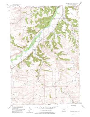
Whitebird School Topo Map Montana
To zoom in, hover over the map of Whitebird School
USGS Topo Quad 45109e3 - 1:24,000 scale
| Topo Map Name: | Whitebird School |
| USGS Topo Quad ID: | 45109e3 |
| Print Size: | ca. 21 1/4" wide x 27" high |
| Southeast Coordinates: | 45.5° N latitude / 109.25° W longitude |
| Map Center Coordinates: | 45.5625° N latitude / 109.3125° W longitude |
| U.S. State: | MT |
| Filename: | o45109e3.jpg |
| Download Map JPG Image: | Whitebird School topo map 1:24,000 scale |
| Map Type: | Topographic |
| Topo Series: | 7.5´ |
| Map Scale: | 1:24,000 |
| Source of Map Images: | United States Geological Survey (USGS) |
| Alternate Map Versions: |
Whitebird School MT 1955, updated 1957 Download PDF Buy paper map Whitebird School MT 1955, updated 1978 Download PDF Buy paper map Whitebird School MT 2011 Download PDF Buy paper map Whitebird School MT 2014 Download PDF Buy paper map |
1:24,000 Topo Quads surrounding Whitebird School
> Back to 45109e1 at 1:100,000 scale
> Back to 45108a1 at 1:250,000 scale
> Back to U.S. Topo Maps home
Whitebird School topo map: Gazetteer
Whitebird School: Canals
Scott Ditch elevation 1143m 3750′Shane Ditch elevation 1131m 3710′
Whitebird Ditch elevation 1169m 3835′
Whitebird School: Cliffs
Firemans Point elevation 1104m 3622′Whitebird School: Streams
Joe Hill Creek elevation 1122m 3681′Mexican Joe Creek elevation 1175m 3854′
Norve Coulee elevation 1162m 3812′
Orson Coulee elevation 1170m 3838′
Porter Coulee elevation 1131m 3710′
Shane Creek elevation 1110m 3641′
Whitebird Creek elevation 1147m 3763′
Whitebird School: Wells
02S20E32ABAA01 Well elevation 1114m 3654′02S20E32ADDC01 Well elevation 1108m 3635′
02S20E32DDBB01 Well elevation 1129m 3704′
03S19E13CACB01 Well elevation 1169m 3835′
03S19E13CBAC01 Well elevation 1161m 3809′
03S19E13CCAA01 Well elevation 1171m 3841′
03S19E13CCAA02 Well elevation 1170m 3838′
03S19E13CCAB01 Well elevation 1163m 3815′
03S19E13CCAD01 Well elevation 1170m 3838′
03S19E23ABCD01 Well elevation 1171m 3841′
03S19E23BABD01 Well elevation 1164m 3818′
03S20E05ABBB01 Well elevation 1137m 3730′
03S20E05ABBB02 Well elevation 1140m 3740′
03S20E05BAAA01 Well elevation 1130m 3707′
03S20E05BAAB01 Well elevation 1132m 3713′
03S20E07AADB01 Well elevation 1139m 3736′
04S19E03BCDA01 Well elevation 1381m 4530′
Whitebird School digital topo map on disk
Buy this Whitebird School topo map showing relief, roads, GPS coordinates and other geographical features, as a high-resolution digital map file on DVD:


