Cow Face Hill Topo Map Montana
To zoom in, hover over the map of Cow Face Hill
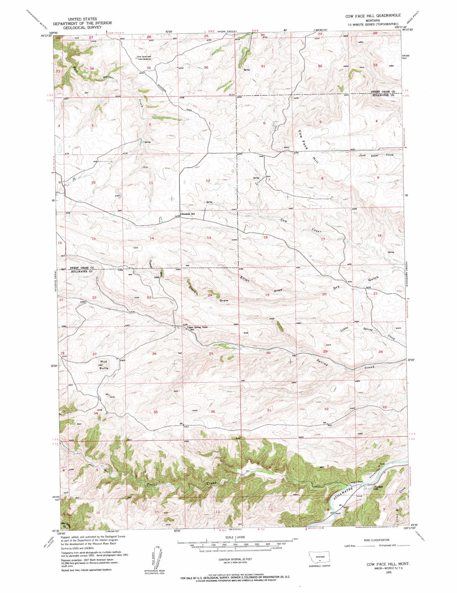
USGS Topo Quad 45109e6 - 1:24,000 scale
| Topo Map Name: | Cow Face Hill |
| USGS Topo Quad ID: | 45109e6 |
| Print Size: | ca. 21 1/4" wide x 27" high |
| Southeast Coordinates: | 45.5° N latitude / 109.625° W longitude |
| Map Center Coordinates: | 45.5625° N latitude / 109.6875° W longitude |
| U.S. State: | MT |
| Filename: | o45109e6.jpg |
| Download Map JPG Image: | Cow Face Hill topo map 1:24,000 scale |
| Map Type: | Topographic |
| Topo Series: | 7.5´ |
| Map Scale: | 1:24,000 |
| Source of Map Images: | United States Geological Survey (USGS) |
| Alternate Map Versions: |
Cow Face Hill MT 1955, updated 1957 Download PDF Buy paper map Cow Face Hill MT 2011 Download PDF Buy paper map Cow Face Hill MT 2014 Download PDF Buy paper map |
1:24,000 Topo Quads surrounding Cow Face Hill
Big Timber |
Greycliff |
Lone Indian Butte |
Stephens Hill |
Antelope Point |
Ross Canyon |
Packsaddle Butte |
Work Creek |
Reed Point |
Springtime |
Sliderock Mountain |
Wildcat Draw |
Cow Face Hill |
Sandborn Creek |
Absarokee |
Meyer Mountain |
Nye |
Beehive |
Fishtail |
Roscoe Nw |
Cathedral Point |
Mount Wood |
Emerald Lake |
Mackay Ranch |
Roscoe |
> Back to 45109e1 at 1:100,000 scale
> Back to 45108a1 at 1:250,000 scale
> Back to U.S. Topo Maps home
Cow Face Hill topo map: Gazetteer
Cow Face Hill: Lakes
Blueball Lake elevation 1349m 4425′Cow Face Hill: Post Offices
Springcreek Post Office (historical) elevation 1561m 5121′Stockade Post Office (historical) elevation 1587m 5206′
Cow Face Hill: Streams
Crazy Man Creek elevation 1337m 4386′Trout Creek elevation 1345m 4412′
Cow Face Hill: Summits
Cow Face Hill elevation 1618m 5308′Mud Butte elevation 1695m 5561′
Cow Face Hill: Valleys
Clark Draw elevation 1476m 4842′Cudney Draw elevation 1596m 5236′
Dry Gulch elevation 1407m 4616′
Elliot Draw elevation 1475m 4839′
Cow Face Hill: Wells
04S17E08BDDA01 Well elevation 1367m 4484′Cow Face Hill digital topo map on disk
Buy this Cow Face Hill topo map showing relief, roads, GPS coordinates and other geographical features, as a high-resolution digital map file on DVD: