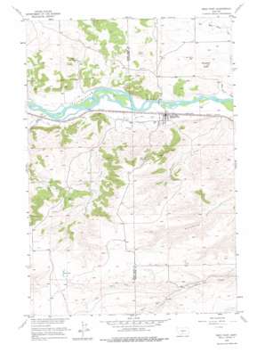
Reed Point Topo Map Montana
To zoom in, hover over the map of Reed Point
USGS Topo Quad 45109f5 - 1:24,000 scale
| Topo Map Name: | Reed Point |
| USGS Topo Quad ID: | 45109f5 |
| Print Size: | ca. 21 1/4" wide x 27" high |
| Southeast Coordinates: | 45.625° N latitude / 109.5° W longitude |
| Map Center Coordinates: | 45.6875° N latitude / 109.5625° W longitude |
| U.S. State: | MT |
| Filename: | o45109f5.jpg |
| Download Map JPG Image: | Reed Point topo map 1:24,000 scale |
| Map Type: | Topographic |
| Topo Series: | 7.5´ |
| Map Scale: | 1:24,000 |
| Source of Map Images: | United States Geological Survey (USGS) |
| Alternate Map Versions: |
Reed Point MT 1955, updated 1957 Download PDF Buy paper map Reed Point MT 1955, updated 1976 Download PDF Buy paper map Reed Point MT 2011 Download PDF Buy paper map Reed Point MT 2014 Download PDF Buy paper map |
1:24,000 Topo Quads surrounding Reed Point
> Back to 45109e1 at 1:100,000 scale
> Back to 45108a1 at 1:250,000 scale
> Back to U.S. Topo Maps home
Reed Point topo map: Gazetteer
Reed Point: Bridges
Reedpoint Bridge elevation 1140m 3740′Reed Point: Canals
Reed Point Ditch elevation 1147m 3763′Reed Point: Crossings
Interchange 392 elevation 1164m 3818′Reed Point: Lakes
Kent Lake elevation 1449m 4753′Reed Point: Populated Places
Reed Point elevation 1142m 3746′Reed Point: Post Offices
Reedpoint Post Office elevation 1142m 3746′Reed Point: Springs
02S17E15DCAC01 Spring elevation 1413m 4635′02S17E15DCDC01 Spring elevation 1423m 4668′
Dahl Spring elevation 1214m 3982′
Reed Point: Streams
Hump Creek elevation 1152m 3779′McClain Coulee elevation 1145m 3756′
North Fork Countryman Creek elevation 1317m 4320′
South Fork Countryman Creek elevation 1316m 4317′
White Beaver Creek elevation 1134m 3720′
Work Creek elevation 1152m 3779′
Reed Point: Summits
Monument Butte elevation 1227m 4025′Reed Point: Wells
01S17E24BCAA01 Well elevation 1216m 3989′01S17E35ABAB01 Well elevation 1161m 3809′
01S17E36AACD01 Well elevation 1157m 3795′
01S18E18CCBA01 Well elevation 1281m 4202′
01S18E30CCAD01 Well elevation 1144m 3753′
01S18E31ADCC01 Well elevation 1209m 3966′
01S18E36DCDB01 Well elevation 1228m 4028′
02S17E11ADAD01 Well elevation 1262m 4140′
02S17E11ADBA01 Well elevation 1272m 4173′
02S17E22AACB01 Well elevation 1447m 4747′
Reed Point digital topo map on disk
Buy this Reed Point topo map showing relief, roads, GPS coordinates and other geographical features, as a high-resolution digital map file on DVD:


