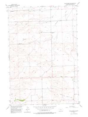
Wheat Basin Sw Topo Map Montana
To zoom in, hover over the map of Wheat Basin Sw
USGS Topo Quad 45109g2 - 1:24,000 scale
| Topo Map Name: | Wheat Basin Sw |
| USGS Topo Quad ID: | 45109g2 |
| Print Size: | ca. 21 1/4" wide x 27" high |
| Southeast Coordinates: | 45.75° N latitude / 109.125° W longitude |
| Map Center Coordinates: | 45.8125° N latitude / 109.1875° W longitude |
| U.S. State: | MT |
| Filename: | o45109g2.jpg |
| Download Map JPG Image: | Wheat Basin Sw topo map 1:24,000 scale |
| Map Type: | Topographic |
| Topo Series: | 7.5´ |
| Map Scale: | 1:24,000 |
| Source of Map Images: | United States Geological Survey (USGS) |
| Alternate Map Versions: |
Wheat Basin SW MT 1956, updated 1958 Download PDF Buy paper map Wheat Basin SW MT 1956, updated 1975 Download PDF Buy paper map Wheat Basin SW MT 2011 Download PDF Buy paper map Wheat Basin SW MT 2014 Download PDF Buy paper map |
1:24,000 Topo Quads surrounding Wheat Basin Sw
> Back to 45109e1 at 1:100,000 scale
> Back to 45108a1 at 1:250,000 scale
> Back to U.S. Topo Maps home
Wheat Basin Sw topo map: Gazetteer
Wheat Basin Sw: Dams
Rummel Dam elevation 1256m 4120′Wheat Basin Sw: Wells
01S20E01CDDC01 Well elevation 1362m 4468′01S21E07CCCB01 Well elevation 1383m 4537′
Wheat Basin Sw digital topo map on disk
Buy this Wheat Basin Sw topo map showing relief, roads, GPS coordinates and other geographical features, as a high-resolution digital map file on DVD:


