Wheat Basin Topo Map Montana
To zoom in, hover over the map of Wheat Basin
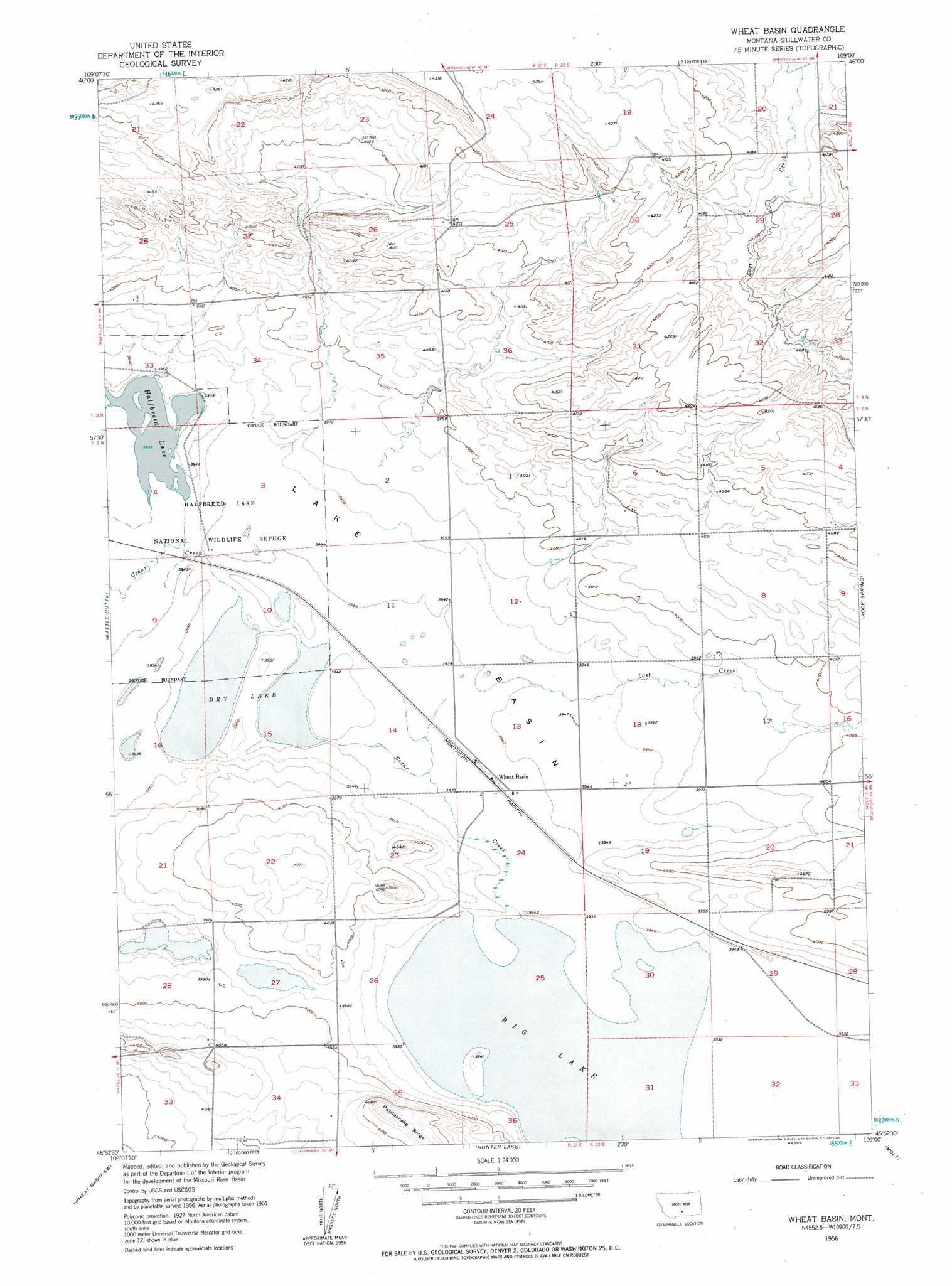
USGS Topo Quad 45109h1 - 1:24,000 scale
| Topo Map Name: | Wheat Basin |
| USGS Topo Quad ID: | 45109h1 |
| Print Size: | ca. 21 1/4" wide x 27" high |
| Southeast Coordinates: | 45.875° N latitude / 109° W longitude |
| Map Center Coordinates: | 45.9375° N latitude / 109.0625° W longitude |
| U.S. State: | MT |
| Filename: | o45109h1.jpg |
| Download Map JPG Image: | Wheat Basin topo map 1:24,000 scale |
| Map Type: | Topographic |
| Topo Series: | 7.5´ |
| Map Scale: | 1:24,000 |
| Source of Map Images: | United States Geological Survey (USGS) |
| Alternate Map Versions: |
Wheat Basin MT 1956, updated 1957 Download PDF Buy paper map Wheat Basin MT 2011 Download PDF Buy paper map Wheat Basin MT 2014 Download PDF Buy paper map |
1:24,000 Topo Quads surrounding Wheat Basin
Locomotive Butte |
Mount Sinai |
Eagle Point |
Belmont |
Broadview Ne |
Locomotive Butte Se |
Hailstone Basin |
Hailstone Basin Se |
Broadview West |
Broadview East |
Rapelje |
Battle Butte |
Wheat Basin |
Rock Spring |
Comanche |
Lindemulder Hill |
Wheat Basin Sw |
Hunter Lake |
Molt |
Two Pine School |
Columbus West |
Columbus East |
Horse Butte |
Park City |
Laurel |
> Back to 45109e1 at 1:100,000 scale
> Back to 45108a1 at 1:250,000 scale
> Back to U.S. Topo Maps home
Wheat Basin topo map: Gazetteer
Wheat Basin: Basins
Lake Basin elevation 1202m 3943′Wheat Basin: Lakes
Big Lake elevation 1198m 3930′Dry Lake elevation 1202m 3943′
Halfbreed Lake elevation 1200m 3937′
Wheat Basin: Parks
Eastlake Pond/Big Lake Waterfowl Management Area elevation 1201m 3940′Halfbreed Lake National Wildlife Refuge elevation 1202m 3943′
Wheat Basin: Post Offices
Stillwater Post Office (historical) elevation 1208m 3963′Wheat Basin Post Office (historical) elevation 1202m 3943′
Wheat Basin: Ridges
Rattlesnake Ridge elevation 1269m 4163′Wheat Basin: Streams
Cedar Creek elevation 1202m 3943′Lost Creek elevation 1202m 3943′
Wheat Basin: Wells
02N21E34CBDD01 Well elevation 1222m 4009′Wheat Basin digital topo map on disk
Buy this Wheat Basin topo map showing relief, roads, GPS coordinates and other geographical features, as a high-resolution digital map file on DVD: