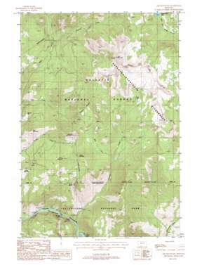
Ash Mountain Topo Map Montana
To zoom in, hover over the map of Ash Mountain
USGS Topo Quad 45110a5 - 1:24,000 scale
| Topo Map Name: | Ash Mountain |
| USGS Topo Quad ID: | 45110a5 |
| Print Size: | ca. 21 1/4" wide x 27" high |
| Southeast Coordinates: | 45° N latitude / 110.5° W longitude |
| Map Center Coordinates: | 45.0625° N latitude / 110.5625° W longitude |
| U.S. State: | MT |
| Filename: | o45110a5.jpg |
| Download Map JPG Image: | Ash Mountain topo map 1:24,000 scale |
| Map Type: | Topographic |
| Topo Series: | 7.5´ |
| Map Scale: | 1:24,000 |
| Source of Map Images: | United States Geological Survey (USGS) |
| Alternate Map Versions: |
Ash Mountain MT 1987, updated 1988 Download PDF Buy paper map Ash Mountain MT 1987, updated 1988 Download PDF Buy paper map Ash Mountain MT 2000, updated 2005 Download PDF Buy paper map Ash Mountain MT 2011 Download PDF Buy paper map Ash Mountain MT 2014 Download PDF Buy paper map |
| FStopo: | US Forest Service topo Ash Mountain is available: Download FStopo PDF Download FStopo TIF |
1:24,000 Topo Quads surrounding Ash Mountain
> Back to 45110a1 at 1:100,000 scale
> Back to 45110a1 at 1:250,000 scale
> Back to U.S. Topo Maps home
Ash Mountain topo map: Gazetteer
Ash Mountain: Falls
Knowles Falls elevation 1694m 5557′Ash Mountain: Lakes
Charlie White Lake elevation 2590m 8497′Crevice Lake elevation 1695m 5561′
Fawn Lake elevation 2706m 8877′
Ash Mountain: Mines
B S Tunnel Mine elevation 2390m 7841′Bald Mountain Mine elevation 2474m 8116′
Bonanza/Kentuck Mine elevation 2585m 8480′
Clark Mine elevation 2478m 8129′
Columbia Mine elevation 2533m 8310′
Conrad 2 Mine elevation 2422m 7946′
Conrad 3 Mine elevation 2422m 7946′
Conrad 6 Mine elevation 2363m 7752′
Conrad Incline Mine elevation 2441m 8008′
Conrad Mine elevation 2484m 8149′
Emma Mine elevation 2571m 8435′
Empire State Mine elevation 2613m 8572′
First Chance Mine elevation 2487m 8159′
First Chance/Lower Mine elevation 2487m 8159′
George Mine elevation 2532m 8307′
Granite Mine elevation 2484m 8149′
Guest Tunnel Mine elevation 2455m 8054′
Helldorado Mine elevation 2619m 8592′
Homestead Mine elevation 2509m 8231′
J Tunnel Mine elevation 2441m 8008′
Jones Cabin Mine elevation 2654m 8707′
Jupiter Mine elevation 2610m 8562′
Kennebeck Mine elevation 2404m 7887′
Little Bonanza Mine elevation 2559m 8395′
M Tunnel Mine elevation 2473m 8113′
McCauley South Mine elevation 2509m 8231′
Medona Mine elevation 2598m 8523′
Medona North Mine elevation 2591m 8500′
NW Section 14 Mine elevation 2642m 8667′
NW Section 22 Mine elevation 2465m 8087′
Pop Incline Mine elevation 2617m 8585′
Pratt Mine elevation 2627m 8618′
Rio Grande Mine elevation 2503m 8211′
SE Section 14 Mine elevation 2640m 8661′
Sin Nombre Mine elevation 2487m 8159′
Snowshoe Mine elevation 2542m 8339′
Spotted Horse Mine elevation 2539m 8330′
Summit Mine elevation 2471m 8106′
Topeka Mine elevation 2515m 8251′
Tower Grove Mine elevation 2555m 8382′
Vindicator Mine elevation 2379m 7805′
Vista 3 Mine elevation 2477m 8126′
Vista Mine elevation 2544m 8346′
Watson Mine elevation 2526m 8287′
Yale-McGinty Mine elevation 2572m 8438′
Ash Mountain: Post Offices
Crevasse Post Office (historical) elevation 2460m 8070′Ash Mountain: Streams
Crevice Creek elevation 1690m 5544′Darroch Creek elevation 2182m 7158′
West Fork Crevice Creek elevation 2238m 7342′
Ash Mountain: Summits
Ash Mountain elevation 3116m 10223′Bald Mountain elevation 2601m 8533′
Buffalo Mountain elevation 2346m 7696′
Crevice Mountain elevation 2691m 8828′
Mineral Hill elevation 2306m 7565′
Oregon Mountain elevation 2680m 8792′
Palmer Mountain elevation 2827m 9274′
Ash Mountain: Trails
Ash Mountain Trail elevation 2887m 9471′Jardine-Hellroaring Trail elevation 2737m 8979′
Ash Mountain digital topo map on disk
Buy this Ash Mountain topo map showing relief, roads, GPS coordinates and other geographical features, as a high-resolution digital map file on DVD:


