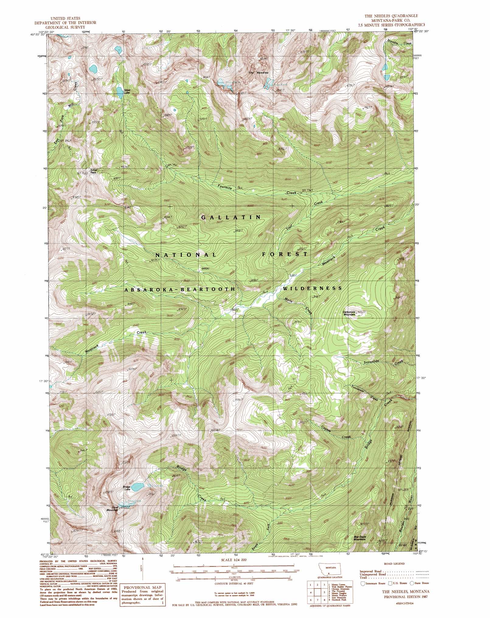
The Needles Topo Map Montana
To zoom in, hover over the map of The Needles
USGS Topo Quad 45110c3 - 1:24,000 scale
| Topo Map Name: | The Needles |
| USGS Topo Quad ID: | 45110c3 |
| Print Size: | ca. 21 1/4" wide x 27" high |
| Southeast Coordinates: | 45.25° N latitude / 110.25° W longitude |
| Map Center Coordinates: | 45.3125° N latitude / 110.3125° W longitude |
| U.S. State: | MT |
| Filename: | o45110c3.jpg |
| Download Map JPG Image: | The Needles topo map 1:24,000 scale |
| Map Type: | Topographic |
| Topo Series: | 7.5´ |
| Map Scale: | 1:24,000 |
| Source of Map Images: | United States Geological Survey (USGS) |
| Alternate Map Versions: |
The Needles MT 1987, updated 1988 Download PDF Buy paper map The Needles MT 2000, updated 2005 Download PDF Buy paper map The Needles MT 2011 Download PDF Buy paper map The Needles MT 2014 Download PDF Buy paper map |
| FStopo: | US Forest Service topo The Needles is available: Download FStopo PDF Download FStopo TIF |
1:24,000 Topo Quads surrounding The Needles
Brisbin |
Livingston Peak |
Mount Rae |
Mcleod Basin |
Squaw Peak |
Dexter Point |
Mount Cowen |
West Boulder Plateau |
Chrome Mountain |
Picket Pin Mountain |
Knowles Peak |
The Pyramid |
The Needles |
Mount Douglas |
Tumble Mountain |
Mineral Mountain |
Mount Wallace |
Iron Mountain |
Haystack Peak |
Pinnacle Mountain |
Ash Mountain |
Specimen Creek |
Hummingbird Peak |
Roundhead Butte |
Cutoff Mountain |
> Back to 45110a1 at 1:100,000 scale
> Back to 45110a1 at 1:250,000 scale
> Back to U.S. Topo Maps home
The Needles topo map: Gazetteer
The Needles: Gaps
Silver Pass elevation 2881m 9452′The Needles: Lakes
Bridge Lake elevation 2897m 9504′Silver Lake elevation 2761m 9058′
The Needles: Streams
Coyote Creek elevation 2278m 7473′Marie Creek elevation 2357m 7732′
South Fork Bridge Creek elevation 2363m 7752′
Trail Creek elevation 2192m 7191′
Tuscarora Creek elevation 2228m 7309′
The Needles: Summits
Boulder Mountain elevation 3178m 10426′Carbonate Mountain elevation 2811m 9222′
Crow Mountain elevation 3254m 10675′
The Needles elevation 3292m 10800′
War Eagle Mountain elevation 2735m 8973′
The Needles digital topo map on disk
Buy this The Needles topo map showing relief, roads, GPS coordinates and other geographical features, as a high-resolution digital map file on DVD: