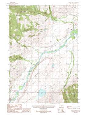
Dailey Lake Topo Map Montana
To zoom in, hover over the map of Dailey Lake
USGS Topo Quad 45110c7 - 1:24,000 scale
| Topo Map Name: | Dailey Lake |
| USGS Topo Quad ID: | 45110c7 |
| Print Size: | ca. 21 1/4" wide x 27" high |
| Southeast Coordinates: | 45.25° N latitude / 110.75° W longitude |
| Map Center Coordinates: | 45.3125° N latitude / 110.8125° W longitude |
| U.S. State: | MT |
| Filename: | o45110c7.jpg |
| Download Map JPG Image: | Dailey Lake topo map 1:24,000 scale |
| Map Type: | Topographic |
| Topo Series: | 7.5´ |
| Map Scale: | 1:24,000 |
| Source of Map Images: | United States Geological Survey (USGS) |
| Alternate Map Versions: |
Dailey Lake MT 1988, updated 1988 Download PDF Buy paper map Dailey Lake MT 1988, updated 1988 Download PDF Buy paper map Dailey Lake MT 2000, updated 2005 Download PDF Buy paper map Dailey Lake MT 2011 Download PDF Buy paper map Dailey Lake MT 2014 Download PDF Buy paper map |
| FStopo: | US Forest Service topo Dailey Lake is available: Download FStopo PDF Download FStopo TIF |
1:24,000 Topo Quads surrounding Dailey Lake
> Back to 45110a1 at 1:100,000 scale
> Back to 45110a1 at 1:250,000 scale
> Back to U.S. Topo Maps home
Dailey Lake topo map: Gazetteer
Dailey Lake: Bridges
Emigrant Creek Bridge elevation 1510m 4954′Dailey Lake: Cliffs
Point of Rocks elevation 1512m 4960′Dailey Lake: Dams
Dailey Lake Dam elevation 1614m 5295′Yastremski Dam elevation 1519m 4983′
Dailey Lake: Lakes
Dailey Lake elevation 1599m 5246′Dailey Lake: Parks
Absaroka-Beartooth Wilderness Historical Marker elevation 1504m 4934′Emigrant Gulch Historical Marker elevation 1498m 4914′
Dailey Lake: Populated Places
Dailey (historical) elevation 1504m 4934′Merriman elevation 1518m 4980′
Dailey Lake: Post Offices
Emigrant Post Office (historical) elevation 1509m 4950′Dailey Lake: Streams
Big Creek elevation 1501m 4924′Donahue Creek elevation 1512m 4960′
Dry Creek elevation 1502m 4927′
Emigrant Creek elevation 1495m 4904′
Fridley Creek elevation 1495m 4904′
Gold Prize Creek elevation 1719m 5639′
Gold Run Creek elevation 1580m 5183′
Goldmeyer Creek elevation 1550m 5085′
Little Donahue Creek elevation 1544m 5065′
Miller Creek elevation 1620m 5314′
Sixmile Creek elevation 1498m 4914′
Dailey Lake digital topo map on disk
Buy this Dailey Lake topo map showing relief, roads, GPS coordinates and other geographical features, as a high-resolution digital map file on DVD:


