Mount Cowen Topo Map Montana
To zoom in, hover over the map of Mount Cowen
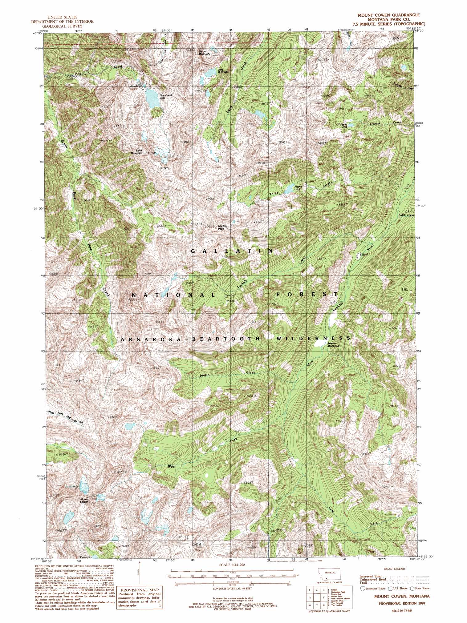
USGS Topo Quad 45110d4 - 1:24,000 scale
| Topo Map Name: | Mount Cowen |
| USGS Topo Quad ID: | 45110d4 |
| Print Size: | ca. 21 1/4" wide x 27" high |
| Southeast Coordinates: | 45.375° N latitude / 110.375° W longitude |
| Map Center Coordinates: | 45.4375° N latitude / 110.4375° W longitude |
| U.S. State: | MT |
| Filename: | o45110d4.jpg |
| Download Map JPG Image: | Mount Cowen topo map 1:24,000 scale |
| Map Type: | Topographic |
| Topo Series: | 7.5´ |
| Map Scale: | 1:24,000 |
| Source of Map Images: | United States Geological Survey (USGS) |
| Alternate Map Versions: |
Mount Cowen MT 1987, updated 1988 Download PDF Buy paper map Mount Cowen MT 2000, updated 2005 Download PDF Buy paper map Mount Cowen MT 2011 Download PDF Buy paper map Mount Cowen MT 2014 Download PDF Buy paper map |
| FStopo: | US Forest Service topo Mount Cowen is available: Download FStopo PDF Download FStopo TIF |
1:24,000 Topo Quads surrounding Mount Cowen
Hoppers |
Livingston |
Mission |
Elton |
Springdale |
Chimney Rock |
Brisbin |
Livingston Peak |
Mount Rae |
Mcleod Basin |
Pray |
Dexter Point |
Mount Cowen |
West Boulder Plateau |
Chrome Mountain |
Emigrant |
Knowles Peak |
The Pyramid |
The Needles |
Mount Douglas |
Monitor Peak |
Mineral Mountain |
Mount Wallace |
Iron Mountain |
Haystack Peak |
> Back to 45110a1 at 1:100,000 scale
> Back to 45110a1 at 1:250,000 scale
> Back to U.S. Topo Maps home
Mount Cowen topo map: Gazetteer
Mount Cowen: Flats
Beaver Meadows elevation 2102m 6896′Mount Cowen: Lakes
Alpine Lake elevation 2653m 8704′Jewel Lake elevation 2739m 8986′
Lake McKnight elevation 2800m 9186′
Pine Creek Lake elevation 2763m 9064′
Trapper Lake elevation 2667m 8750′
Mount Cowen: Streams
East Fork West Boulder River elevation 2314m 7591′Falls Creek elevation 1942m 6371′
Jungle Creek elevation 2143m 7030′
Three Creeks elevation 1924m 6312′
Tumble Creek elevation 1994m 6541′
West Fork West Boulder River elevation 2175m 7135′
Mount Cowen: Summits
Black Mountain elevation 3337m 10948′Marten Peak elevation 3213m 10541′
Mount Cowen elevation 3369m 11053′
Mount McKnight elevation 3139m 10298′
Mount Cowen digital topo map on disk
Buy this Mount Cowen topo map showing relief, roads, GPS coordinates and other geographical features, as a high-resolution digital map file on DVD: