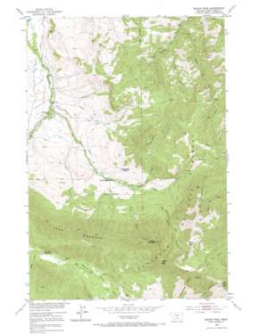
Squaw Peak Topo Map Montana
To zoom in, hover over the map of Squaw Peak
USGS Topo Quad 45110e1 - 1:24,000 scale
| Topo Map Name: | Squaw Peak |
| USGS Topo Quad ID: | 45110e1 |
| Print Size: | ca. 21 1/4" wide x 27" high |
| Southeast Coordinates: | 45.5° N latitude / 110° W longitude |
| Map Center Coordinates: | 45.5625° N latitude / 110.0625° W longitude |
| U.S. State: | MT |
| Filename: | o45110e1.jpg |
| Download Map JPG Image: | Squaw Peak topo map 1:24,000 scale |
| Map Type: | Topographic |
| Topo Series: | 7.5´ |
| Map Scale: | 1:24,000 |
| Source of Map Images: | United States Geological Survey (USGS) |
| Alternate Map Versions: |
Squaw Peak MT 1951, updated 1953 Download PDF Buy paper map Squaw Peak MT 1951, updated 1969 Download PDF Buy paper map Enos Mountain MT 2000, updated 2006 Download PDF Buy paper map Enos Mountain MT 2011 Download PDF Buy paper map Enos Mountain MT 2014 Download PDF Buy paper map |
| FStopo: | US Forest Service topo Enos Mountain is available: Download FStopo PDF Download FStopo TIF |
1:24,000 Topo Quads surrounding Squaw Peak
> Back to 45110e1 at 1:100,000 scale
> Back to 45110a1 at 1:250,000 scale
> Back to U.S. Topo Maps home
Squaw Peak topo map: Gazetteer
Squaw Peak: Basins
Clover Basin elevation 2506m 8221′Squaw Peak: Canals
Craft Ditch elevation 1671m 5482′Woolsey Ditch elevation 1677m 5501′
Squaw Peak: Ridges
Long Mountain elevation 2493m 8179′Squaw Peak: Springs
03S13E15BABA01 Spring elevation 1599m 5246′04S13E12BABB01 Spring elevation 2017m 6617′
04S13E12BCCD01 Spring elevation 1955m 6414′
04S13E12BDCC01 Spring elevation 1962m 6437′
Squaw Peak: Streams
Corral Creek elevation 1666m 5465′Dry Fork Creek elevation 1915m 6282′
East Sheep Creek elevation 1826m 5990′
Elk Creek elevation 1562m 5124′
Enos Creek elevation 1557m 5108′
Horse Creek elevation 1632m 5354′
Lost Cabin Creek elevation 1774m 5820′
Middle Fork Upper Deer Creek elevation 1620m 5314′
West Sheep Creek elevation 1781m 5843′
Squaw Peak: Summits
Boone Mountain elevation 2726m 8943′Elk Mountain elevation 2553m 8375′
Enos Mountain elevation 2256m 7401′
Morning Star Peak elevation 2821m 9255′
Squaw Peak: Valleys
Lewis Gulch elevation 2085m 6840′Skookum Joe Canyon elevation 1932m 6338′
Wright Gulch elevation 1797m 5895′
Squaw Peak: Wells
03S13E04AABD01 Well elevation 1501m 4924′03S13E04ABAD01 Well elevation 1502m 4927′
03S13E14CCCA01 Well elevation 1645m 5396′
04S12E25CBBD01 Well elevation 1612m 5288′
04S13E04ABAA01 Well elevation 1781m 5843′
04S13E12BCBA01 Well elevation 1950m 6397′
04S13E12BCBA02 Well elevation 1950m 6397′
04S13E12BCBA03 Well elevation 1946m 6384′
04S13E12BCBA04 Well elevation 1946m 6384′
04S13E12BCBA05 Well elevation 1946m 6384′
04S13E12BCBA06 Well elevation 1946m 6384′
04S13E12BCBA07 Well elevation 1946m 6384′
Squaw Peak digital topo map on disk
Buy this Squaw Peak topo map showing relief, roads, GPS coordinates and other geographical features, as a high-resolution digital map file on DVD:


