Mount Ellis Topo Map Montana
To zoom in, hover over the map of Mount Ellis
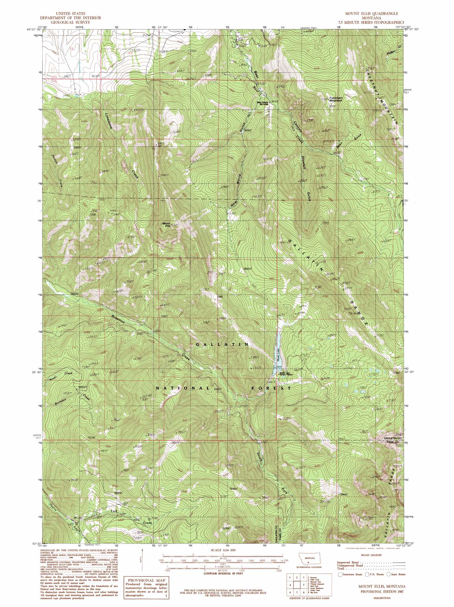
USGS Topo Quad 45110e8 - 1:24,000 scale
| Topo Map Name: | Mount Ellis |
| USGS Topo Quad ID: | 45110e8 |
| Print Size: | ca. 21 1/4" wide x 27" high |
| Southeast Coordinates: | 45.5° N latitude / 110.875° W longitude |
| Map Center Coordinates: | 45.5625° N latitude / 110.9375° W longitude |
| U.S. State: | MT |
| Filename: | o45110e8.jpg |
| Download Map JPG Image: | Mount Ellis topo map 1:24,000 scale |
| Map Type: | Topographic |
| Topo Series: | 7.5´ |
| Map Scale: | 1:24,000 |
| Source of Map Images: | United States Geological Survey (USGS) |
| Alternate Map Versions: |
Mount Ellis MT 1987, updated 1987 Download PDF Buy paper map Mount Ellis MT 1987, updated 1987 Download PDF Buy paper map Mount Ellis MT 2000, updated 2005 Download PDF Buy paper map Mount Ellis MT 2011 Download PDF Buy paper map Mount Ellis MT 2014 Download PDF Buy paper map |
| FStopo: | US Forest Service topo Mount Ellis is available: Download FStopo PDF Download FStopo TIF |
1:24,000 Topo Quads surrounding Mount Ellis
Belgrade |
Miser Creek |
Saddle Peak |
Grassy Mountain |
Gobblers Knob |
Bozeman Hot Springs |
Bozeman |
Kelly Creek |
Bozeman Pass |
Hoppers |
Gallatin Gateway |
Wheeler Mountain |
Mount Ellis |
Bald Knob |
Chimney Rock |
Garnet Mountain |
Mount Blackmore |
Fridley Peak |
Big Draw |
Pray |
Hidden Lake |
The Sentinel |
Lewis Creek |
Dailey Lake |
Emigrant |
> Back to 45110e1 at 1:100,000 scale
> Back to 45110a1 at 1:250,000 scale
> Back to U.S. Topo Maps home
Mount Ellis topo map: Gazetteer
Mount Ellis: Dams
Mystic Lake Dam elevation 1974m 6476′Mount Ellis: Lakes
Mystic Lake elevation 1950m 6397′Mount Ellis: Reservoirs
Mystic Lake elevation 1974m 6476′Mount Ellis: Streams
Lick Creek elevation 1948m 6391′South Fork Bozeman Creek elevation 1877m 6158′
Mount Ellis: Summits
Chestnut Mountain elevation 2337m 7667′Francham Mountain elevation 2172m 7125′
Mount Ellis elevation 2542m 8339′
Mount Ellis: Valleys
Dean Gulch elevation 1780m 5839′New World Gulch elevation 1653m 5423′
Shoefelt Gulch elevation 1763m 5784′
Mount Ellis: Wells
02S06E33ADAC01 Well elevation 1654m 5426′02S06E33BDDC01 Well elevation 1656m 5433′
02S06E36CB__01 Well elevation 1663m 5456′
Mount Ellis digital topo map on disk
Buy this Mount Ellis topo map showing relief, roads, GPS coordinates and other geographical features, as a high-resolution digital map file on DVD: