Ibex Mountain Topo Map Montana
To zoom in, hover over the map of Ibex Mountain
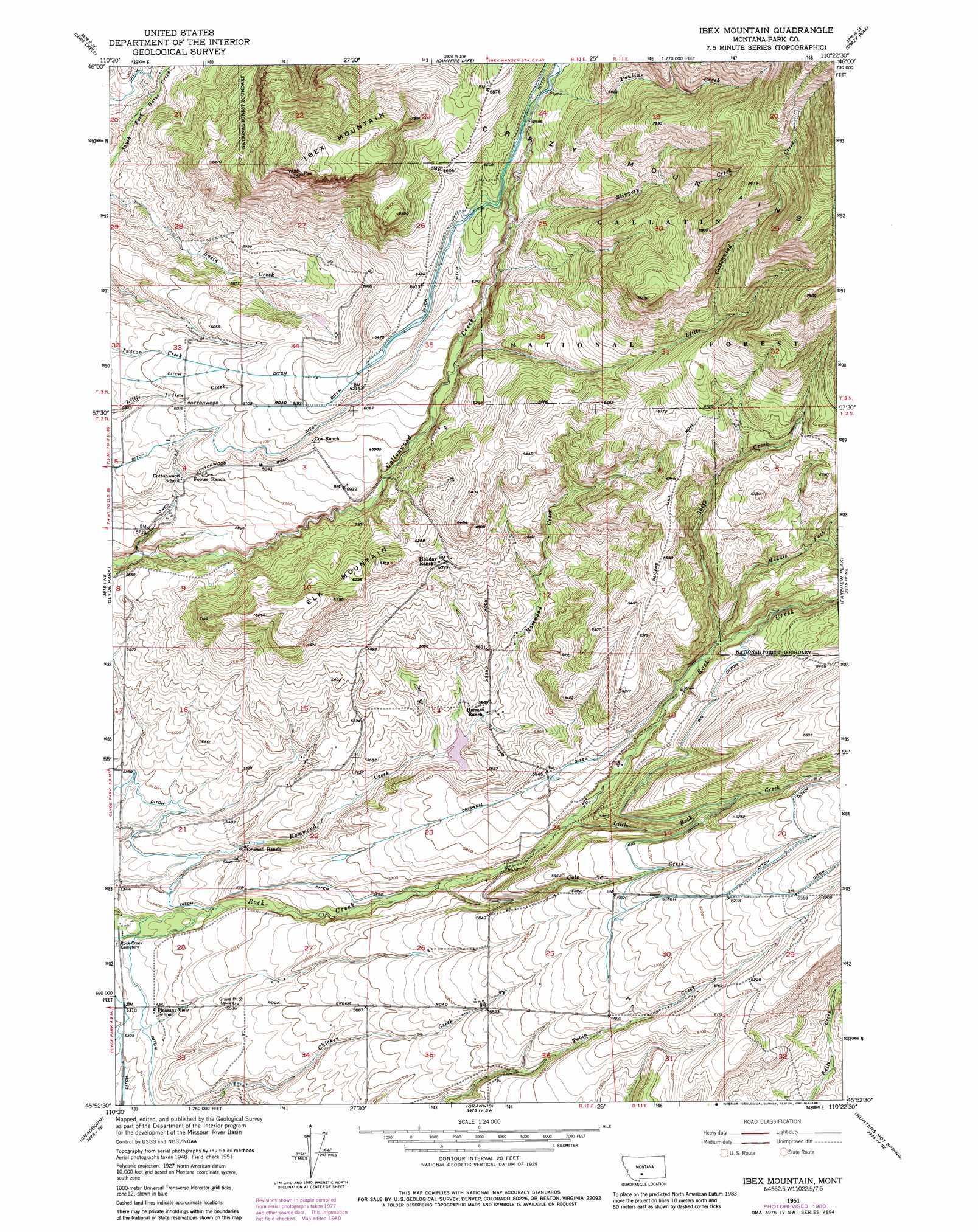
USGS Topo Quad 45110h4 - 1:24,000 scale
| Topo Map Name: | Ibex Mountain |
| USGS Topo Quad ID: | 45110h4 |
| Print Size: | ca. 21 1/4" wide x 27" high |
| Southeast Coordinates: | 45.875° N latitude / 110.375° W longitude |
| Map Center Coordinates: | 45.9375° N latitude / 110.4375° W longitude |
| U.S. State: | MT |
| Filename: | o45110h4.jpg |
| Download Map JPG Image: | Ibex Mountain topo map 1:24,000 scale |
| Map Type: | Topographic |
| Topo Series: | 7.5´ |
| Map Scale: | 1:24,000 |
| Source of Map Images: | United States Geological Survey (USGS) |
| Alternate Map Versions: |
Ibex Mountain MT 1951, updated 1952 Download PDF Buy paper map Ibex Mountain MT 1951, updated 1977 Download PDF Buy paper map Ibex Mountain MT 1951, updated 1981 Download PDF Buy paper map Ibex Mountain MT 1951, updated 1981 Download PDF Buy paper map Ibex Mountain MT 2000, updated 2005 Download PDF Buy paper map Ibex Mountain MT 2011 Download PDF Buy paper map Ibex Mountain MT 2014 Download PDF Buy paper map |
| FStopo: | US Forest Service topo Ibex Mountain is available: Download FStopo PDF Download FStopo TIF |
1:24,000 Topo Quads surrounding Ibex Mountain
Wolf Hill |
Scab Rock Mountain |
Virginia Peak |
Loco Mountain |
Rein Lake |
Cotttonwood Reservoir |
Lena Creek |
Campfire Lake |
Crazy Peak |
Amelong Creek |
Wilsall |
Clyde Park |
Ibex Mountain |
Fairview Peak |
Raspberry Butte |
Gobblers Knob |
Chadborn |
Grannis |
Hunters Hot Springs |
Kelly Hills |
Hoppers |
Livingston |
Mission |
Elton |
Springdale |
> Back to 45110e1 at 1:100,000 scale
> Back to 45110a1 at 1:250,000 scale
> Back to U.S. Topo Maps home
Ibex Mountain topo map: Gazetteer
Ibex Mountain: Airports
Crazy Mountain Ranch Airport elevation 1648m 5406′Ibex Mountain: Canals
Big Ditch elevation 1867m 6125′Criswell Ditch elevation 1787m 5862′
Ibex Mountain: Dams
Nauharodney Dam elevation 1723m 5652′Ibex Mountain: Post Offices
Criswell Post Office (historical) elevation 1670m 5479′Ibex Mountain: Springs
02N10E11A___01 Spring elevation 1877m 6158′Ibex Mountain: Streams
Cole Creek elevation 1707m 5600′Little Cottonwood Creek elevation 1828m 5997′
Little Rock Creek elevation 1755m 5757′
Middle Fork Rock Creek elevation 1840m 6036′
Pauline Creek elevation 1978m 6489′
Sheep Creek elevation 1842m 6043′
Slippery Creek elevation 1890m 6200′
Ibex Mountain: Summits
Elk Mountain elevation 1944m 6377′Ibex Mountain elevation 2242m 7355′
Ibex Mountain: Wells
02N10E04D___01 Well elevation 1780m 5839′02N10E33BA__01 Well elevation 1642m 5387′
Ibex Mountain digital topo map on disk
Buy this Ibex Mountain topo map showing relief, roads, GPS coordinates and other geographical features, as a high-resolution digital map file on DVD: