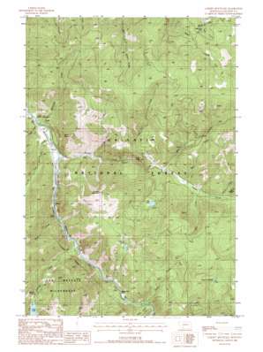
Garnet Mountain Topo Map Montana
To zoom in, hover over the map of Garnet Mountain
USGS Topo Quad 45111d2 - 1:24,000 scale
| Topo Map Name: | Garnet Mountain |
| USGS Topo Quad ID: | 45111d2 |
| Print Size: | ca. 21 1/4" wide x 27" high |
| Southeast Coordinates: | 45.375° N latitude / 111.125° W longitude |
| Map Center Coordinates: | 45.4375° N latitude / 111.1875° W longitude |
| U.S. State: | MT |
| Filename: | o45111d2.jpg |
| Download Map JPG Image: | Garnet Mountain topo map 1:24,000 scale |
| Map Type: | Topographic |
| Topo Series: | 7.5´ |
| Map Scale: | 1:24,000 |
| Source of Map Images: | United States Geological Survey (USGS) |
| Alternate Map Versions: |
Garnet Mountain MT 1988, updated 1988 Download PDF Buy paper map Garnet Mountain MT 1988, updated 1988 Download PDF Buy paper map Garnet Mountain MT 2000, updated 2005 Download PDF Buy paper map Garnet Mountain MT 2011 Download PDF Buy paper map Garnet Mountain MT 2014 Download PDF Buy paper map |
| FStopo: | US Forest Service topo Garnet Mountain is available: Download FStopo PDF Download FStopo TIF |
1:24,000 Topo Quads surrounding Garnet Mountain
> Back to 45111a1 at 1:100,000 scale
> Back to 45110a1 at 1:250,000 scale
> Back to U.S. Topo Maps home
Garnet Mountain topo map: Gazetteer
Garnet Mountain: Bridges
Old Trail Bridge (historical) elevation 1666m 5465′Squaw Creek Bridge elevation 1620m 5314′
Garnet Mountain: Capes
Sagebrush Point elevation 1756m 5761′Garnet Mountain: Falls
Hoodoo Cascade elevation 2129m 6984′Garnet Mountain: Flats
Beckman Flat elevation 1645m 5396′Garnet Mountain: Lakes
Lake of the Pines elevation 2192m 7191′Lava Lake elevation 2166m 7106′
Little Bear Lake elevation 2231m 7319′
Pioneer Lakes elevation 2194m 7198′
Rat Lake elevation 1983m 6505′
Garnet Mountain: Mines
Mica Creek Mine elevation 1960m 6430′Mica Mine elevation 1936m 6351′
Thumper Mica Mine elevation 2537m 8323′
Garnet Mountain: Streams
Burnt Creek elevation 1720m 5643′Cascade Creek elevation 1682m 5518′
Cave Creek elevation 1665m 5462′
Greek Creek elevation 1726m 5662′
Hell Roaring Creek elevation 1633m 5357′
Lime Creek elevation 1750m 5741′
Line Creek elevation 1804m 5918′
Logger Creek elevation 1621m 5318′
Mica Creek elevation 1775m 5823′
Purdy Creek elevation 1679m 5508′
Shenango Creek elevation 1621m 5318′
Smith Creek elevation 1838m 6030′
Storm Castle Creek elevation 1643m 5390′
West Creek elevation 1794m 5885′
Garnet Mountain: Summits
Avalanche Spire Rock elevation 2052m 6732′Garnet Mountain elevation 2500m 8202′
Spire Rock elevation 1944m 6377′
Storm Castle elevation 2184m 7165′
Garnet Mountain: Valleys
Gallatin Canyon elevation 1642m 5387′Garnet Mountain digital topo map on disk
Buy this Garnet Mountain topo map showing relief, roads, GPS coordinates and other geographical features, as a high-resolution digital map file on DVD:


