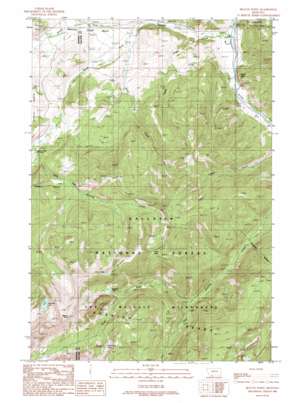
Beacon Point Topo Map Montana
To zoom in, hover over the map of Beacon Point
USGS Topo Quad 45111d3 - 1:24,000 scale
| Topo Map Name: | Beacon Point |
| USGS Topo Quad ID: | 45111d3 |
| Print Size: | ca. 21 1/4" wide x 27" high |
| Southeast Coordinates: | 45.375° N latitude / 111.25° W longitude |
| Map Center Coordinates: | 45.4375° N latitude / 111.3125° W longitude |
| U.S. State: | MT |
| Filename: | o45111d3.jpg |
| Download Map JPG Image: | Beacon Point topo map 1:24,000 scale |
| Map Type: | Topographic |
| Topo Series: | 7.5´ |
| Map Scale: | 1:24,000 |
| Source of Map Images: | United States Geological Survey (USGS) |
| Alternate Map Versions: |
Beacon Point MT 1988, updated 1989 Download PDF Buy paper map Beacon Point MT 1988, updated 1989 Download PDF Buy paper map Beacon Point MT 2000, updated 2005 Download PDF Buy paper map Beacon Point MT 2011 Download PDF Buy paper map Beacon Point MT 2014 Download PDF Buy paper map |
| FStopo: | US Forest Service topo Beacon Point is available: Download FStopo PDF Download FStopo TIF |
1:24,000 Topo Quads surrounding Beacon Point
> Back to 45111a1 at 1:100,000 scale
> Back to 45110a1 at 1:250,000 scale
> Back to U.S. Topo Maps home
Beacon Point topo map: Gazetteer
Beacon Point: Bridges
Benham Bridge elevation 1608m 5275′Beacon Point: Lakes
Arrow Lake elevation 2736m 8976′Diamond Lake elevation 2714m 8904′
Grayling Lake elevation 2541m 8336′
North Fork Lake elevation 2697m 8848′
Beacon Point: Pillars
Sheep Rock elevation 1793m 5882′Beacon Point: Populated Places
Beacon Point elevation 3047m 9996′Beacon Point: Ridges
Indian Ridge elevation 2845m 9333′Beacon Point: Streams
Hyde Creek elevation 1613m 5291′Little Hell Roaring Creek elevation 1852m 6076′
North Fork Hell Roaring Creek elevation 1959m 6427′
North Fork Spanish Creek elevation 1660m 5446′
South Fork Spanish Creek elevation 1651m 5416′
Spanish Creek elevation 1583m 5193′
Twin Creek elevation 1669m 5475′
Beacon Point: Wells
01S04E17DCDD01 Well elevation 1636m 5367′04S04E18ACAA01 Well elevation 1591m 5219′
Beacon Point digital topo map on disk
Buy this Beacon Point topo map showing relief, roads, GPS coordinates and other geographical features, as a high-resolution digital map file on DVD:


