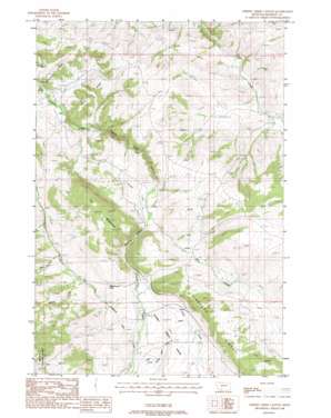
Cherry Creek Canyon Topo Map Montana
To zoom in, hover over the map of Cherry Creek Canyon
USGS Topo Quad 45111e4 - 1:24,000 scale
| Topo Map Name: | Cherry Creek Canyon |
| USGS Topo Quad ID: | 45111e4 |
| Print Size: | ca. 21 1/4" wide x 27" high |
| Southeast Coordinates: | 45.5° N latitude / 111.375° W longitude |
| Map Center Coordinates: | 45.5625° N latitude / 111.4375° W longitude |
| U.S. State: | MT |
| Filename: | o45111e4.jpg |
| Download Map JPG Image: | Cherry Creek Canyon topo map 1:24,000 scale |
| Map Type: | Topographic |
| Topo Series: | 7.5´ |
| Map Scale: | 1:24,000 |
| Source of Map Images: | United States Geological Survey (USGS) |
| Alternate Map Versions: |
Cherry Creek Canyon MT 1988, updated 1988 Download PDF Buy paper map Cherry Creek Canyon MT 2000, updated 2005 Download PDF Buy paper map Cherry Creek Canyon MT 2011 Download PDF Buy paper map Cherry Creek Canyon MT 2014 Download PDF Buy paper map |
| FStopo: | US Forest Service topo Cherry Creek Canyon is available: Download FStopo PDF Download FStopo TIF |
1:24,000 Topo Quads surrounding Cherry Creek Canyon
> Back to 45111e1 at 1:100,000 scale
> Back to 45110a1 at 1:250,000 scale
> Back to U.S. Topo Maps home
Cherry Creek Canyon topo map: Gazetteer
Cherry Creek Canyon: Basins
Cherry Creek Basin elevation 1743m 5718′Cherry Creek Canyon: Canals
Butler Ditch elevation 1624m 5328′Carpenter Creek Ditch elevation 1779m 5836′
Lower Ditch elevation 1418m 4652′
Upper Cherry Creek Ditch elevation 1783m 5849′
Upper Ditch elevation 1467m 4812′
Cherry Creek Canyon: Gaps
McCormack Pass elevation 1773m 5816′Cherry Creek Canyon: Mines
Cooper Mine elevation 1509m 4950′Turner Ranch Mine elevation 1535m 5036′
Cherry Creek Canyon: Post Offices
Havana Post Office (historical) elevation 1436m 4711′Cherry Creek Canyon: Ridges
Finnegan Ridge elevation 1968m 6456′Savannah Ridge elevation 1578m 5177′
Wiley Ridge elevation 1552m 5091′
Cherry Creek Canyon: Streams
Carpenter Creek elevation 1748m 5734′East Fork Cherry Creek elevation 1700m 5577′
East Fork Pole Creek elevation 1658m 5439′
Middle Fork Pole Creek elevation 1657m 5436′
Mill Creek elevation 1667m 5469′
West Fork Pole Creek elevation 1639m 5377′
Cherry Creek Canyon: Summits
Elk Mountain elevation 2016m 6614′Cherry Creek Canyon: Valleys
Cherry Creek Canyon elevation 1410m 4625′Cowboy Canyon elevation 1670m 5479′
Cherry Creek Canyon digital topo map on disk
Buy this Cherry Creek Canyon topo map showing relief, roads, GPS coordinates and other geographical features, as a high-resolution digital map file on DVD:


