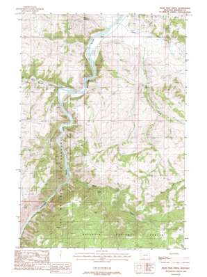
Bear Trap Creek Topo Map Montana
To zoom in, hover over the map of Bear Trap Creek
USGS Topo Quad 45111e5 - 1:24,000 scale
| Topo Map Name: | Bear Trap Creek |
| USGS Topo Quad ID: | 45111e5 |
| Print Size: | ca. 21 1/4" wide x 27" high |
| Southeast Coordinates: | 45.5° N latitude / 111.5° W longitude |
| Map Center Coordinates: | 45.5625° N latitude / 111.5625° W longitude |
| U.S. State: | MT |
| Filename: | o45111e5.jpg |
| Download Map JPG Image: | Bear Trap Creek topo map 1:24,000 scale |
| Map Type: | Topographic |
| Topo Series: | 7.5´ |
| Map Scale: | 1:24,000 |
| Source of Map Images: | United States Geological Survey (USGS) |
| Alternate Map Versions: |
Bear Trap Creek MT 1988, updated 1988 Download PDF Buy paper map Bear Trap Creek MT 2000, updated 2005 Download PDF Buy paper map Bear Trap Creek MT 2011 Download PDF Buy paper map Bear Trap Creek MT 2014 Download PDF Buy paper map |
| FStopo: | US Forest Service topo Bear Trap Creek is available: Download FStopo PDF Download FStopo TIF |
1:24,000 Topo Quads surrounding Bear Trap Creek
> Back to 45111e1 at 1:100,000 scale
> Back to 45110a1 at 1:250,000 scale
> Back to U.S. Topo Maps home
Bear Trap Creek topo map: Gazetteer
Bear Trap Creek: Bridges
Madison River Bridge elevation 1356m 4448′Bear Trap Creek: Mines
Bear Trap Creek Mine elevation 2007m 6584′Bear Trap Creek Number 2 Mine elevation 1969m 6459′
Copper King Mine elevation 1711m 5613′
Moore Ranch Number 1 Mine elevation 1438m 4717′
Moore Ranch Number 2 Mine elevation 1402m 4599′
Moore Ranch Number 3 Mine elevation 1482m 4862′
Morning Star Mine elevation 1751m 5744′
NE NW Section 21 Mine elevation 1740m 5708′
NE NW Section 28 Mine elevation 1600m 5249′
NE SE Section 21 Mine elevation 1520m 4986′
NW NE Section 15 Mine elevation 1389m 4557′
Savannah Ridge Mine elevation 1435m 4708′
Bear Trap Creek: Post Offices
Lewis Post Office (historical) elevation 1359m 4458′Bear Trap Creek: Streams
Bear Trap Creek elevation 1400m 4593′Cherry Creek elevation 1349m 4425′
Cold Spring Creek elevation 1357m 4452′
Hot Springs Creek elevation 1373m 4504′
Pole Creek elevation 1359m 4458′
Bear Trap Creek: Summits
Red Mountain elevation 1749m 5738′Bear Trap Creek: Wells
03S01E02BDC_01 Well elevation 1362m 4468′Bear Trap Creek digital topo map on disk
Buy this Bear Trap Creek topo map showing relief, roads, GPS coordinates and other geographical features, as a high-resolution digital map file on DVD:


