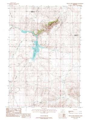
Willow Creek Reservoir Topo Map Montana
To zoom in, hover over the map of Willow Creek Reservoir
USGS Topo Quad 45111f6 - 1:24,000 scale
| Topo Map Name: | Willow Creek Reservoir |
| USGS Topo Quad ID: | 45111f6 |
| Print Size: | ca. 21 1/4" wide x 27" high |
| Southeast Coordinates: | 45.625° N latitude / 111.625° W longitude |
| Map Center Coordinates: | 45.6875° N latitude / 111.6875° W longitude |
| U.S. State: | MT |
| Filename: | o45111f6.jpg |
| Download Map JPG Image: | Willow Creek Reservoir topo map 1:24,000 scale |
| Map Type: | Topographic |
| Topo Series: | 7.5´ |
| Map Scale: | 1:24,000 |
| Source of Map Images: | United States Geological Survey (USGS) |
| Alternate Map Versions: |
Willow Creek Reservoir MT 1971, updated 1975 Download PDF Buy paper map Willow Creek Reservoir MT 1988, updated 1988 Download PDF Buy paper map Willow Creek Reservoir MT 2011 Download PDF Buy paper map Willow Creek Reservoir MT 2014 Download PDF Buy paper map |
1:24,000 Topo Quads surrounding Willow Creek Reservoir
> Back to 45111e1 at 1:100,000 scale
> Back to 45110a1 at 1:250,000 scale
> Back to U.S. Topo Maps home
Willow Creek Reservoir topo map: Gazetteer
Willow Creek Reservoir: Dams
Willow Creek Dam elevation 1460m 4790′Willow Creek Reservoir: Reservoirs
Willow Creek Reservoir elevation 1442m 4730′Willow Creek Reservoir: Streams
Dry Hollow Creek elevation 1444m 4737′North Willow Creek elevation 1451m 4760′
Norwegian Creek elevation 1444m 4737′
South Willow Creek elevation 1451m 4760′
Willow Creek Reservoir: Wells
01S01W34DCDD01 Well elevation 1447m 4747′Willow Creek Reservoir digital topo map on disk
Buy this Willow Creek Reservoir topo map showing relief, roads, GPS coordinates and other geographical features, as a high-resolution digital map file on DVD:


